Chillupār geodata
Chillupār (Uttar Pradesh) is a populated place; located in India in Asia/Kolkata (GMT+5.5) time zone. With population of 20,518 people, there are 2000 cities with bigger population in this country. Compared to other cities in India, 72.8% of cities are located further ↓South; 80.7% of cities are located further ←West and 72.9% of cities have higher elevation than Chillupār. Note1


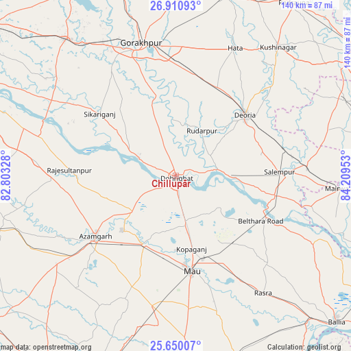
Chillupār GPS coordinates[2]
26° 16' 55.956" North, 83° 30' 23.04" East
| Map corner | latitude | longitude |
|---|---|---|
| Upper-left | 26.91093°, | 82.80328° |
| Center: | 26.28221°, | 83.5064° |
| Lower-right: | 25.65007°, | 84.20953° |
| Map W x H: | 140.2×140.2 km | = 87.1×87.1mi |
| max Lat: | 34.9274° ⇑27.2% North |
| Chillupār: | 26.28221° |
| min Lat: | ⇓72.8% South 8.09008° |
| min Long | Chillupār | max Long |
| 68.82655° | 83.5064° | 96.81° |
| W 80.7%⇐ | ⇒19.3% E |
Elevation
Elevation of Chillupār is 80 m = 262 ft, and this is 215.6 m = 707 ft below average elevation for this country.
| Max E: |
3681 m = 12077 ft | 72.9% |
| Avg. | 295.6 m = 970 ft | |
| Chillupār | 80 m = 262 ft | |
Min E: |
1 m = 3 ft | 27.1% |
See also: India elevation on elevation.city.
Geographical zone
Chillupār is located in North temperate zone (between Tropic of Cancer and the Arctic Circle). Distance of this Northern Tropic circle is 316.4 km =196.6 mi to South.| Distance of | km | miles | from Chillupār |
|---|---|---|---|
| North Pole | 7084.8 | 4402.3 | to North |
| Arctic Circle | 4478.9 | 2783.1 | to North |
| Tropic Cancer | 316.4 | 196.6 | to South |
| Equator | 2922.3 | 1815.8 | to South |


Nearby cities:
15 places around Chillupār: (largest is in red/bold)
• Azamgarh
40 km =24.9 mi,  233°
233°
• Bilariāganj
29.5 km =18.3 mi,  251°
251°
• Bilthra
42.1 km =26.2 mi,  114°
114°
• Bishunpur Urf Mahārājganj
39 km =24.2 mi,  266°
266°
• Bānsgāon
33.9 km =21.1 mi,  331°
331°
• Deoria
36.5 km =22.7 mi,  48°
48°
• Dohrighāt
1.1 km =0.7 mi,  166°
166°
• Ghosī
19.9 km =12.4 mi, 170°
• Gola Bāzār
16.8 km =10.4 mi,  294°
294°
• Jainpur
22.3 km =13.9 mi, 230°
• Kopāganj
29.8 km =18.5 mi, 168°
• Mau
38.3 km =23.8 mi, 171°
• Mubārakpur
30.4 km =18.9 mi,  224°
224°
• Muhammadābād
30.3 km =18.8 mi,  204°
204°
• Rūdarpur
21 km =13 mi,  30°
30°
Sources, notices
• [Note1] Compared only with cities in India existing in our database
• [Src1] Map data: © OpenStreetMap contributors (CC-BY-SA)
• [Src2] Other city data from geonames.org with taken over terms of usage.
• [Src3] Geographical zone / Annual Mean Temperature by Robert A. Rohde @ Wikipedia
