Chēlakara geodata
Chēlakara (Kerala) is a populated place; located in India in Asia/Kolkata (GMT+5.5) time zone. With population of 8,936 people, there are 3038 cities with bigger population in this country. Compared to other cities in India, 94.4% of cities are located further ↑North; 69.9% of cities are located further →East and 81.1% of cities have higher elevation than Chēlakara. Note1


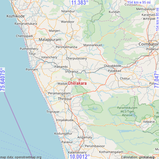
Chēlakara GPS coordinates[2]
10° 41' 34.404" North, 76° 20' 37.932" East
| Map corner | latitude | longitude |
|---|---|---|
| Upper-left | 11.383°, | 75.64075° |
| Center: | 10.69289°, | 76.34387° |
| Lower-right: | 10.0012°, | 77.047° |
| Map W x H: | 153.6×153.6 km | = 95.4×95.4mi |
| max Lat: | 34.9274° ⇑94.4% North |
| Chēlakara: | 10.69289° |
| min Lat: | ⇓5.6% South 8.09008° |
| min Long | Chēlakara | max Long |
| 68.82655° | 76.34387° | 96.81° |
| W 30.1%⇐ | ⇒69.9% E |
Elevation
Elevation of Chēlakara is 44 m = 144 ft, and this is 251.6 m = 825 ft below average elevation for this country.
| Max E: |
3681 m = 12077 ft | 81.1% |
| Avg. | 295.6 m = 970 ft | |
| Chēlakara | 44 m = 144 ft | |
Min E: |
1 m = 3 ft | 18.9% |
See also: India elevation on elevation.city.
Geographical zone
Chēlakara is located in North Torrid zone (between Equator and Tropic of Cancer). Distance of Equator is 1188.9 km =738.7 mi to South.| Distance of | km | miles | from Chēlakara |
|---|---|---|---|
| North Pole | 8818.1 | 5479.3 | to North |
| Arctic Circle | 6212.2 | 3860.1 | to North |
| Tropic Cancer | 1417 | 880.5 | to North |
| Equator | 1188.9 | 738.7 | to South |


Nearby cities:
15 places around Chēlakara: (largest is in red/bold)
• Avanoor
20.6 km =12.8 mi,  242°
242°
• Cherpulassery
20.8 km =12.9 mi,  349°
349°
• Chetwayi
37.1 km =23.1 mi, 240°
• Chittūr
44.1 km =27.4 mi,  89°
89°
• Edakkulam
19.8 km =12.3 mi, 242°
• Guruvāyūr
34.9 km =21.7 mi,  251°
251°
• Irinjālakuda
41.6 km =25.8 mi,  200°
200°
• Kizhake Chālakudi
43.6 km =27.1 mi,  180°
180°
• Kunnamkulam
30.7 km =19.1 mi,  260°
260°
• Mannārakkāt
35.8 km =22.2 mi,  21°
21°
• Ottappālam
9.7 km =6 mi, 22°
• Pālghāt
35 km =21.7 mi,  75°
75°
• Shōranūr
11.1 km =6.9 mi,  313°
313°
• Thanniyam
38.4 km =23.9 mi,  216°
216°
• Thrissur
24 km =14.9 mi, 215°
Sources, notices
• [Note1] Compared only with cities in India existing in our database
• [Src1] Map data: © OpenStreetMap contributors (CC-BY-SA)
• [Src2] Other city data from geonames.org with taken over terms of usage.
• [Src3] Geographical zone / Annual Mean Temperature by Robert A. Rohde @ Wikipedia
