Mukeriān geodata
Mukeriān (Punjab) is a populated place; located in India in Asia/Kolkata (GMT+5.5) time zone. With population of 22,751 people, there are 1853 cities with bigger population in this country. Compared to other cities in India, 97.8% of cities are located further ↓South; 77.4% of cities are located further →East and 61.9% of cities have lower elevation than Mukeriān. Note1


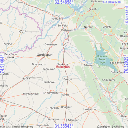
Mukeriān GPS coordinates[2]
31° 57' 14.184" North, 75° 37' 1.776" East
| Map corner | latitude | longitude |
|---|---|---|
| Upper-left | 32.54858°, | 74.91404° |
| Center: | 31.95394°, | 75.61716° |
| Lower-right: | 31.35543°, | 76.32029° |
| Map W x H: | 132.7×132.7 km | = 82.5×82.5mi |
| max Lat: | 34.9274° ⇑2.2% North |
| Mukeriān: | 31.95394° |
| min Lat: | ⇓97.8% South 8.09008° |
| min Long | Mukeriān | max Long |
| 68.82655° | 75.61716° | 96.81° |
| W 22.6%⇐ | ⇒77.4% E |
Elevation
Elevation of Mukeriān is 264 m = 866 ft, and this is 31.6 m = 104 ft below average elevation for this country.
| Max E: |
3681 m = 12077 ft | 38.1% |
| Avg. | 295.6 m = 970 ft | |
| Mukeriān | 264 m = 866 ft | |
Min E: |
1 m = 3 ft | 61.9% |
See also: India elevation on elevation.city.
Geographical zone
Mukeriān is located in North temperate zone (between Tropic of Cancer and the Arctic Circle). Distance of this Northern Tropic circle is 947 km =588.4 mi to South.| Distance of | km | miles | from Mukeriān |
|---|---|---|---|
| North Pole | 6454.1 | 4010.4 | to North |
| Arctic Circle | 3848.2 | 2391.2 | to North |
| Tropic Cancer | 947 | 588.4 | to South |
| Equator | 3552.9 | 2207.7 | to South |


Nearby cities:
15 places around Mukeriān: (largest is in red/bold)
• Batāla
42.3 km =26.3 mi,  247°
247°
• Begowāl
39.1 km =24.3 mi,  193°
193°
• Bhogpur
44.5 km =27.7 mi,  176°
176°
• Dasūya
15.6 km =9.7 mi,  167°
167°
• Daulatpur
39.8 km =24.7 mi,  117°
117°
• Dhāriwāl
27.7 km =17.2 mi,  270°
270°
• Dīnānagar
24.4 km =15.2 mi,  326°
326°
• Garhdiwāla
27 km =16.8 mi,  151°
151°
• Hariāna
41.2 km =25.6 mi, 149°
• Hājipur
13.2 km =8.2 mi,  78°
78°
• Kalanaur
44.5 km =27.7 mi,  278°
278°
• Nagrota
46.2 km =28.7 mi, 75°
• Pathānkot
35.8 km =22.2 mi,  5°
5°
• Qādiān
27 km =16.8 mi,  237°
237°
• Talwāra
25.5 km =15.8 mi,  94°
94°
Sources, notices
• [Note1] Compared only with cities in India existing in our database
• [Src1] Map data: © OpenStreetMap contributors (CC-BY-SA)
• [Src2] Other city data from geonames.org with taken over terms of usage.
• [Src3] Geographical zone / Annual Mean Temperature by Robert A. Rohde @ Wikipedia
