Bāramūla geodata
Bāramūla (Jammu and Kashmir) is a populated place; located in India in Asia/Kolkata (GMT+5.5) time zone. With population of 77,276 people, there are 565 cities with bigger population in this country. Compared to other cities in India, 99.8% of cities are located further ↓South; 87.7% of cities are located further →East and 98% of cities have lower elevation than Bāramūla. Note1


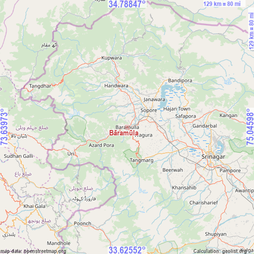
Bāramūla GPS coordinates[2]
34° 12' 32.4" North, 74° 20' 34.26" East
| Map corner | latitude | longitude |
|---|---|---|
| Upper-left | 34.78847°, | 73.63973° |
| Center: | 34.209°, | 74.34285° |
| Lower-right: | 33.62552°, | 75.04598° |
| Map W x H: | 129.3×129.3 km | = 80.3×80.3mi |
| max Lat: | 34.9274° ⇑0.2% North |
| Bāramūla: | 34.209° |
| min Lat: | ⇓99.8% South 8.09008° |
| min Long | Bāramūla | max Long |
| 68.82655° | 74.34285° | 96.81° |
| W 12.3%⇐ | ⇒87.7% E |
Elevation
Elevation of Bāramūla is 1579 m = 5180 ft, and this is 1283.4 m = 4211 ft above average elevation for this country.
| Max E: |
3681 m = 12077 ft | 2% |
| Bāramūla | 1579 m 5180 ft | |
| Avg. | 295.6 m = 970 ft | |
Min E: |
1 m = 3 ft | 98% |
See also: Bāramūla elevation on elevation.city.
Geographical zone
Bāramūla is located in North temperate zone (between Tropic of Cancer and the Arctic Circle). Distance of this Northern Tropic circle is 1197.8 km =744.3 mi to South.| Distance of | km | miles | from Bāramūla |
|---|---|---|---|
| North Pole | 6203.4 | 3854.6 | to North |
| Arctic Circle | 3597.5 | 2235.4 | to North |
| Tropic Cancer | 1197.8 | 744.3 | to South |
| Equator | 3803.7 | 2363.5 | to South |


Nearby cities:
15 places around Bāramūla: (largest is in red/bold)
• Bandipura
36 km =22.4 mi,  49°
49°
• Gulmarg
17.6 km =10.9 mi,  168°
168°
• Gāndarbal
39.8 km =24.7 mi,  87°
87°
• Hājan
27.1 km =16.8 mi,  68°
68°
• Kupwāra
21.1 km =13.1 mi,  200°
200°
• Māgām
26.2 km =16.3 mi,  119°
119°
• Pattan
20.3 km =12.6 mi,  105°
105°
• Pulwama
63.4 km =39.4 mi,  125°
125°
• Pūnch
54 km =33.6 mi,  205°
205°
• Sopur
14.7 km =9.1 mi, 54°
• Soyībug
36.5 km =22.7 mi, 113°
• Srinagar
44.7 km =27.8 mi, 107°
• Sumbal
28.1 km =17.5 mi, 85°
• Tsrār Sharīf
54.7 km =34 mi, 134°
• Uri
30.4 km =18.9 mi,  242°
242°
Sources, notices
• [Note1] Compared only with cities in India existing in our database
• [Src1] Map data: © OpenStreetMap contributors (CC-BY-SA)
• [Src2] Other city data from geonames.org with taken over terms of usage.
• [Src3] Geographical zone / Annual Mean Temperature by Robert A. Rohde @ Wikipedia
