Ar Riyāḑ geodata
Ar Riyāḑ (Kirkuk) is a seat of a third-order administrative division; located in Iraq in Asia/Baghdad (GMT+3) time zone. In our database, there are 71 cities with bigger population. Compared to other cities in Iraq, 59.9% of cities are located further ↓South; 69% of cities are located further →East and 56.3% of cities have lower elevation than Ar Riyāḑ. Note1


Ar Riyāḑ GPS coordinates[2]
35° 16' 10.704" North, 43° 54' 38.412" East
| Map corner | latitude | longitude |
|---|---|---|
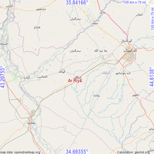
| Upper-left | 35.84166°, | 43.20755° |
| Center: | 35.26964°, | 43.91067° |
| Lower-right: | 34.69355°, | 44.6138° |
| Map W x H: | 127.7×127.7 km | = 79.3×79.3mi |
| max Lat: | 37.22781° ⇑40.1% North |
| Ar Riyāḑ: | 35.26964° |
| min Lat: | ⇓59.9% South 29.97421° |
| min Long | Ar Riyāḑ | max Long |
| 40.28586° | 43.91067° | 48.47309° |
| W 31%⇐ | ⇒69% E |
Elevation
Elevation of Ar Riyāḑ is 189 m = 620 ft, and this is 104 m = 341 ft below average elevation for this country.
| Max E: |
1316 m = 4318 ft | 43.7% |
| Avg. | 293 m = 961 ft | |
| Ar Riyāḑ | 189 m = 620 ft | |
Min E: |
1 m = 3 ft | 56.3% |
See also: Iraq elevation on elevation.city.
Geographical zone
Ar Riyāḑ is located in North temperate zone (between Tropic of Cancer and the Arctic Circle). Distance of this Northern Tropic circle is 1315.7 km =817.5 mi to South.| Distance of | km | miles | from Ar Riyāḑ |
|---|---|---|---|
| North Pole | 6085.4 | 3781.3 | to North |
| Arctic Circle | 3479.6 | 2162.1 | to North |
| Tropic Cancer | 1315.7 | 817.5 | to South |
| Equator | 3921.6 | 2436.8 | to South |


Nearby cities:
15 places around Ar Riyāḑ: (largest is in red/bold)
• Ad Dawr
91.1 km =56.6 mi,  186°
186°
• Al Qayyārah
81.1 km =50.4 mi,  316°
316°
• Al Ḩawījah
14 km =8.7 mi,  296°
296°
• Al ‘Abbāsī
28.6 km =17.8 mi,  271°
271°
• Al ‘Awjah
83.5 km =51.9 mi, 191°
• Ash Sharqāt
67.7 km =42.1 mi,  293°
293°
• Bayjī
53.9 km =33.5 mi,  225°
225°
• Dibis
47.3 km =29.4 mi,  17°
17°
• Dāqūq
51 km =31.7 mi,  106°
106°
• Jamjamāl
88.7 km =55.1 mi,  70°
70°
• Kirkuk
48.9 km =30.4 mi,  63°
63°
• Mexmur
63.8 km =39.6 mi,  332°
332°
• Qushtepe
82.2 km =51.1 mi,  8°
8°
• Tikrīt
75.7 km =47 mi,  196°
196°
• Tozkhurmato
78.2 km =48.6 mi,  122°
122°
Sources, notices
• [Note1] Compared only with cities in Iraq existing in our database
• [Src1] Map data: © OpenStreetMap contributors (CC-BY-SA)
• [Src2] Other city data from geonames.org with taken over terms of usage.
• [Src3] Geographical zone / Annual Mean Temperature by Robert A. Rohde @ Wikipedia
