Kirkuk geodata
Kirkuk is a seat of a first-order administrative division; located in Iraq in Asia/Baghdad (GMT+3) time zone. With population of 601,433 people, there are 8 cities with bigger population in this country. Compared to other cities in Iraq, 64.1% of cities are located further ↓South; 55.6% of cities are located further →East and 67.6% of cities have lower elevation than Kirkuk. Note1


Kirkuk GPS coordinates[2]
35° 28' 5.016" North, 44° 23' 31.992" East
| Map corner | latitude | longitude |
|---|---|---|
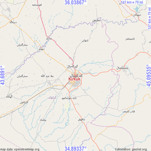
| Upper-left | 36.03867°, | 43.6891° |
| Center: | 35.46806°, | 44.39222° |
| Lower-right: | 34.89337°, | 45.09535° |
| Map W x H: | 127.3×127.3 km | = 79.1×79.1mi |
| max Lat: | 37.22781° ⇑35.9% North |
| Kirkuk: | 35.46806° |
| min Lat: | ⇓64.1% South 29.97421° |
| min Long | Kirkuk | max Long |
| 40.28586° | 44.39222° | 48.47309° |
| W 44.4%⇐ | ⇒55.6% E |
Elevation
Elevation of Kirkuk is 346 m = 1135 ft, and this is 53 m = 174 ft above average elevation for this country.
| Max E: |
1316 m = 4318 ft | 32.4% |
| Kirkuk | 346 m 1135 ft | |
| Avg. | 293 m = 961 ft | |
Min E: |
1 m = 3 ft | 67.6% |
See also: Kirkuk elevation on elevation.city.
Geographical zone
Kirkuk is located in North temperate zone (between Tropic of Cancer and the Arctic Circle). Distance of this Northern Tropic circle is 1337.8 km =831.3 mi to South.| Distance of | km | miles | from Kirkuk |
|---|---|---|---|
| North Pole | 6063.4 | 3767.6 | to North |
| Arctic Circle | 3457.5 | 2148.4 | to North |
| Tropic Cancer | 1337.8 | 831.3 | to South |
| Equator | 3943.7 | 2450.5 | to South |


Nearby cities:
15 places around Kirkuk: (largest is in red/bold)
• Al Ḩawījah
58.3 km =36.2 mi,  254°
254°
• Al ‘Abbāsī
75.3 km =46.8 mi, 253°
• Ar Riyāḑ
48.9 km =30.4 mi,  243°
243°
• Dare Tû
78.5 km =48.8 mi,  337°
337°
• Dibis
37.1 km =23.1 mi,  308°
308°
• Dukan
72.7 km =45.2 mi,  45°
45°
• Dāqūq
36.9 km =22.9 mi,  171°
171°
• Erbil
86.6 km =53.8 mi, 336°
• Hīrān
90.5 km =56.2 mi,  5°
5°
• Jamjamāl
40.7 km =25.3 mi,  79°
79°
• Kasnazān
84.8 km =52.7 mi, 343°
• Koysinceq
71.6 km =44.5 mi,  17°
17°
• Mexmur
81 km =50.3 mi,  295°
295°
• Qushtepe
67.4 km =41.9 mi,  331°
331°
• Tozkhurmato
68.1 km =42.3 mi,  161°
161°
Sources, notices
• [Note1] Compared only with cities in Iraq existing in our database
• [Src1] Map data: © OpenStreetMap contributors (CC-BY-SA)
• [Src2] Other city data from geonames.org with taken over terms of usage.
• [Src3] Geographical zone / Annual Mean Temperature by Robert A. Rohde @ Wikipedia
