Tozkhurmato geodata
Tozkhurmato (Salah ad Din) is a seat of a second-order administrative division; located in Iraq in Asia/Baghdad (GMT+3) time zone. With population of 59,886 people, there are 34 cities with bigger population in this country. Compared to other cities in Iraq, 56.3% of cities are located further ↓South; 58.5% of cities are located further ←West and 59.9% of cities have lower elevation than Tozkhurmato. Note1


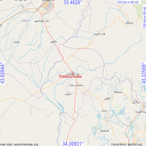
Tozkhurmato GPS coordinates[2]
34° 53' 17.088" North, 44° 37' 57.216" East
| Map corner | latitude | longitude |
|---|---|---|
| Upper-left | 35.4628°, | 43.92944° |
| Center: | 34.88808°, | 44.63256° |
| Lower-right: | 34.30931°, | 45.33569° |
| Map W x H: | 128.3×128.3 km | = 79.7×79.7mi |
| max Lat: | 37.22781° ⇑43.7% North |
| Tozkhurmato: | 34.88808° |
| min Lat: | ⇓56.3% South 29.97421° |
| min Long | Tozkhurmato | max Long |
| 40.28586° | 44.63256° | 48.47309° |
| W 58.5%⇐ | ⇒41.5% E |
Elevation
Elevation of Tozkhurmato is 227 m = 745 ft, and this is 66 m = 217 ft below average elevation for this country.
| Max E: |
1316 m = 4318 ft | 40.1% |
| Avg. | 293 m = 961 ft | |
| Tozkhurmato | 227 m = 745 ft | |
Min E: |
1 m = 3 ft | 59.9% |
See also: Tozkhurmato elevation on elevation.city.
Geographical zone
Tozkhurmato is located in North temperate zone (between Tropic of Cancer and the Arctic Circle). Distance of this Northern Tropic circle is 1273.3 km =791.2 mi to South.| Distance of | km | miles | from Tozkhurmato |
|---|---|---|---|
| North Pole | 6127.9 | 3807.7 | to North |
| Arctic Circle | 3522 | 2188.5 | to North |
| Tropic Cancer | 1273.3 | 791.2 | to South |
| Equator | 3879.2 | 2410.4 | to South |


Nearby cities:
15 places around Tozkhurmato: (largest is in red/bold)
• Ad Dawr
90.5 km =56.2 mi,  237°
237°
• Al Ḩawījah
92.1 km =57.2 mi,  301°
301°
• Al ‘Awjah
91.2 km =56.7 mi, 244°
• Ar Riyāḑ
78.2 km =48.6 mi, 302°
• Derbendîxan
99.2 km =61.6 mi,  75°
75°
• Dibis
101.3 km =62.9 mi,  329°
329°
• Dāqūq
32.5 km =20.2 mi, 329°
• Jamjamāl
74.1 km =46 mi,  14°
14°
• Kelar
69 km =42.9 mi,  114°
114°
• Khānaqīn
91.7 km =57 mi,  130°
130°
• Kifrī
37.2 km =23.1 mi, 126°
• Kirkuk
68.1 km =42.3 mi,  341°
341°
• Qeredagh
83.2 km =51.7 mi,  55°
55°
• Sāmarrā’
103 km =64 mi,  221°
221°
• Tikrīt
92.3 km =57.4 mi,  250°
250°
Sources, notices
• [Note1] Compared only with cities in Iraq existing in our database
• [Src1] Map data: © OpenStreetMap contributors (CC-BY-SA)
• [Src2] Other city data from geonames.org with taken over terms of usage.
• [Src3] Geographical zone / Annual Mean Temperature by Robert A. Rohde @ Wikipedia
