An Nu‘mānīyah geodata
An Nu‘mānīyah (Wāsiţ) is a seat of a second-order administrative division; located in Iraq in Asia/Baghdad (GMT+3) time zone. In our database, there are 71 cities with bigger population. Compared to other cities in Iraq, 70.4% of cities are located further ↑North; 75.4% of cities are located further ←West and 75.4% of cities have higher elevation than An Nu‘mānīyah. Note1


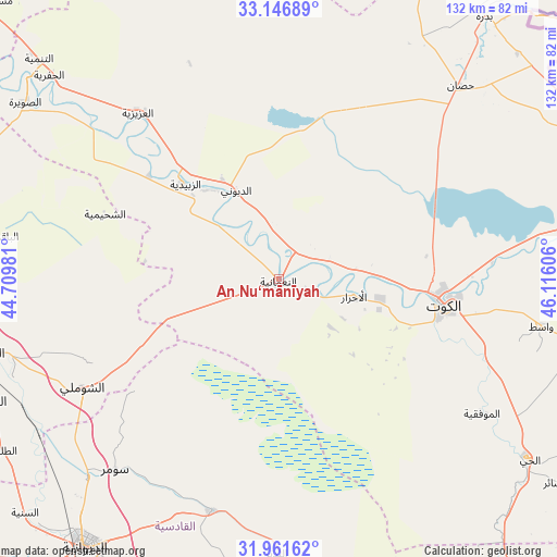
An Nu‘mānīyah GPS coordinates[2]
32° 33' 22.356" North, 45° 24' 46.548" East
| Map corner | latitude | longitude |
|---|---|---|
| Upper-left | 33.14689°, | 44.70981° |
| Center: | 32.55621°, | 45.41293° |
| Lower-right: | 31.96162°, | 46.11606° |
| Map W x H: | 131.8×131.8 km | = 81.9×81.9mi |
| max Lat: | 37.22781° ⇑70.4% North |
| An Nu‘mānīyah: | 32.55621° |
| min Lat: | ⇓29.6% South 29.97421° |
| min Long | An Nu‘mānīy | max Long |
| 40.28586° | 45.41293° | 48.47309° |
| W 75.4%⇐ | ⇒24.6% E |
Elevation
Elevation of An Nu‘mānīyah is 27 m = 89 ft, and this is 266 m = 873 ft below average elevation for this country.
| Max E: |
1316 m = 4318 ft | 75.4% |
| Avg. | 293 m = 961 ft | |
| An Nu‘mānīyah | 27 m = 89 ft | |
Min E: |
1 m = 3 ft | 24.6% |
See also: Iraq elevation on elevation.city.
Geographical zone
An Nu‘mānīyah is located in North temperate zone (between Tropic of Cancer and the Arctic Circle). Distance of this Northern Tropic circle is 1014 km =630.1 mi to South.| Distance of | km | miles | from An Nu‘mānīyah |
|---|---|---|---|
| North Pole | 6387.2 | 3968.8 | to North |
| Arctic Circle | 3781.3 | 2349.6 | to North |
| Tropic Cancer | 1014 | 630.1 | to South |
| Equator | 3619.9 | 2249.3 | to South |


Nearby cities:
15 places around An Nu‘mānīyah: (largest is in red/bold)
• Ad Dīwānīyah
77.6 km =48.2 mi,  216°
216°
• Al Hāshimīyah
73.8 km =45.9 mi,  253°
253°
• Al Kūt
38.3 km =23.8 mi,  97°
97°
• Al Maḩāwīl
94.8 km =58.9 mi,  277°
277°
• Al Ḩamzah
101.2 km =62.9 mi,  203°
203°
• Al Ḩayy
72.9 km =45.3 mi,  125°
125°
• Al Ḩillah
93.7 km =58.2 mi,  263°
263°
• Al ‘Azīzīyah
51.1 km =31.8 mi,  320°
320°
• Ash Shāmīyah
100.9 km =62.7 mi,  229°
229°
• Aş Şuwayrah
72.4 km =45 mi,  304°
304°
• Badrah
78.9 km =49 mi,  38°
38°
• Imam Qasim
74.3 km =46.2 mi, 247°
• Kufa
107.3 km =66.7 mi,  238°
238°
• Nāḩīyat Saddat al Hindīyah
107.7 km =66.9 mi, 279°
• ‘Afak
56.9 km =35.4 mi, 195°
Sources, notices
• [Note1] Compared only with cities in Iraq existing in our database
• [Src1] Map data: © OpenStreetMap contributors (CC-BY-SA)
• [Src2] Other city data from geonames.org with taken over terms of usage.
• [Src3] Geographical zone / Annual Mean Temperature by Robert A. Rohde @ Wikipedia
