Badrah geodata
Badrah (Wāsiţ) is a seat of a second-order administrative division; located in Iraq in Asia/Baghdad (GMT+3) time zone. In our database, there are 71 cities with bigger population. Compared to other cities in Iraq, 63.4% of cities are located further ↑North; 81.7% of cities are located further ←West and 57.7% of cities have higher elevation than Badrah. Note1


Badrah GPS coordinates[2]
33° 6' 54.288" North, 45° 56' 0.384" East
| Map corner | latitude | longitude |
|---|---|---|
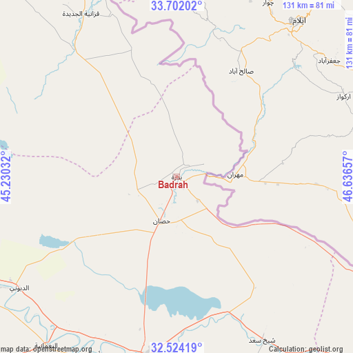
| Upper-left | 33.70202°, | 45.23032° |
| Center: | 33.11508°, | 45.93344° |
| Lower-right: | 32.52419°, | 46.63657° |
| Map W x H: | 131×131 km | = 81.4×81.4mi |
| max Lat: | 37.22781° ⇑63.4% North |
| Badrah: | 33.11508° |
| min Lat: | ⇓36.6% South 29.97421° |
| min Long | Badrah | max Long |
| 40.28586° | 45.93344° | 48.47309° |
| W 81.7%⇐ | ⇒18.3% E |
Elevation
Elevation of Badrah is 60 m = 197 ft, and this is 233 m = 764 ft below average elevation for this country.
| Max E: |
1316 m = 4318 ft | 57.7% |
| Avg. | 293 m = 961 ft | |
| Badrah | 60 m = 197 ft | |
Min E: |
1 m = 3 ft | 42.3% |
See also: Iraq elevation on elevation.city.
Geographical zone
Badrah is located in North temperate zone (between Tropic of Cancer and the Arctic Circle). Distance of this Northern Tropic circle is 1076.1 km =668.7 mi to South.| Distance of | km | miles | from Badrah |
|---|---|---|---|
| North Pole | 6325 | 3930.2 | to North |
| Arctic Circle | 3719.1 | 2310.9 | to North |
| Tropic Cancer | 1076.1 | 668.7 | to South |
| Equator | 3682.1 | 2288 | to South |


Nearby cities:
15 places around Badrah: (largest is in red/bold)
• Al Hāshimīyah
145.5 km =90.4 mi,  234°
234°
• Al Kūt
67.8 km =42.1 mi,  189°
189°
• Al Miqdādīyah
133.2 km =82.8 mi,  316°
316°
• Al Ḩayy
105.1 km =65.3 mi,  174°
174°
• Al ‘Azīzīyah
84.3 km =52.4 mi,  254°
254°
• An Nu‘mānīyah
78.9 km =49 mi,  218°
218°
• Aş Şuwayrah
110 km =68.4 mi,  258°
258°
• Baghdad
144.7 km =89.9 mi,  279°
279°
• Baladrūz
102.4 km =63.6 mi,  309°
309°
• Baqubah
142.3 km =88.4 mi,  299°
299°
• Khānaqīn
146 km =90.7 mi,  339°
339°
• Mandalī
78.7 km =48.9 mi,  333°
333°
• Nāḩiyat Alī ash Sharqī
134.2 km =83.4 mi,  145°
145°
• ‘Afak
133.3 km =82.8 mi,  208°
208°
• ‘Alī al Gharbī
101.2 km =62.9 mi,  135°
135°
Sources, notices
• [Note1] Compared only with cities in Iraq existing in our database
• [Src1] Map data: © OpenStreetMap contributors (CC-BY-SA)
• [Src2] Other city data from geonames.org with taken over terms of usage.
• [Src3] Geographical zone / Annual Mean Temperature by Robert A. Rohde @ Wikipedia
