Shahr-e Qods geodata
Shahr-e Qods (Tehrān) is a seat of a second-order administrative division; located in Iran in Asia/Tehran (GMT+3.5) time zone. In our database, there are 232 cities with bigger population. Compared to other cities in Iran, 66% of cities are located further ↓South; 51.7% of cities are located further →East and 50.8% of cities have lower elevation than Shahr-e Qods. Note1


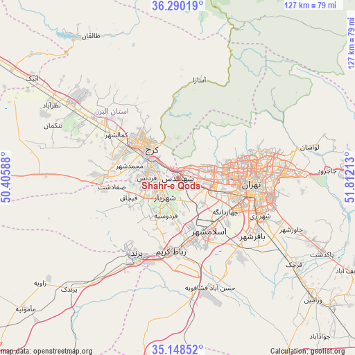
Shahr-e Qods GPS coordinates[2]
35° 43' 17.04" North, 51° 6' 32.4" East
| Map corner | latitude | longitude |
|---|---|---|
| Upper-left | 36.29019°, | 50.40588° |
| Center: | 35.7214°, | 51.109° |
| Lower-right: | 35.14852°, | 51.81213° |
| Map W x H: | 126.9×126.9 km | = 78.9×78.9mi |
| max Lat: | 39.6482° ⇑34% North |
| Shahr-e Qods: | 35.7214° |
| min Lat: | ⇓66% South 25.2919° |
| min Long | Shahr-e Qods | max Long |
| 44.38416° | 51.109° | 61.9965° |
| W 48.3%⇐ | ⇒51.7% E |
Elevation
Elevation of Shahr-e Qods is 1181 m = 3875 ft, and this is 132 m = 433 ft above average elevation for this country.
| Max E: |
2564 m = 8412 ft | 49.2% |
| Shahr-e Qods | 1181 m 3875 ft | |
| Avg. | 1049 m = 3442 ft | |
Min E: |
-24 m = -79 ft | 50.8% |
See also: Iran elevation on elevation.city.
Geographical zone
Shahr-e Qods is located in North temperate zone (between Tropic of Cancer and the Arctic Circle). Distance of this Northern Tropic circle is 1365.9 km =848.7 mi to South.| Distance of | km | miles | from Shahr-e Qods |
|---|---|---|---|
| North Pole | 6035.2 | 3750.1 | to North |
| Arctic Circle | 3429.3 | 2130.9 | to North |
| Tropic Cancer | 1365.9 | 848.7 | to South |
| Equator | 3971.8 | 2468 | to South |


Nearby cities:
15 places around Shahr-e Qods: (largest is in red/bold)
• Eslāmshahr
22 km =13.7 mi,  148°
148°
• Hashtgerd
47 km =29.2 mi,  304°
304°
• Karaj
16.3 km =10.1 mi,  319°
319°
• Malārd
13.4 km =8.3 mi,  242°
242°
• Naz̧arābād
52.2 km =32.4 mi, 299°
• Pākdasht
58.5 km =36.4 mi,  117°
117°
• Qarchak
53.3 km =33.1 mi,  127°
127°
• Rey
33.1 km =20.6 mi, 115°
• Robāţ Karīm
26.4 km =16.4 mi,  185°
185°
• Shahrak-e Emām Ḩasan
33.6 km =20.9 mi,  140°
140°
• Shahre Jadide Andisheh
9.3 km =5.8 mi, 240°
• Shahrīār
8.4 km =5.2 mi,  213°
213°
• Tajrīsh
30 km =18.6 mi,  72°
72°
• Tehran
28.4 km =17.6 mi,  96°
96°
• Ţāleb ābād
45.4 km =28.2 mi, 122°
Sources, notices
• [Note1] Compared only with cities in Iran existing in our database
• [Src1] Map data: © OpenStreetMap contributors (CC-BY-SA)
• [Src2] Other city data from geonames.org with taken over terms of usage.
• [Src3] Geographical zone / Annual Mean Temperature by Robert A. Rohde @ Wikipedia
