Karaj geodata
Karaj (Alborz) is a seat of a first-order administrative division; located in Iran in Asia/Tehran (GMT+3.5) time zone. With population of 1,448,075 people, there are 3 cities with bigger population in this country. Compared to other cities in Iran, 67.3% of cities are located further ↓South; 53.1% of cities are located further →East and 60.8% of cities have lower elevation than Karaj. Note1


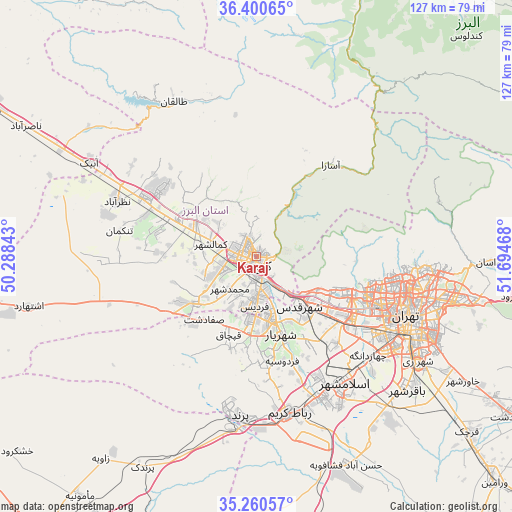
Karaj GPS coordinates[2]
35° 49' 57.576" North, 50° 59' 29.58" East
| Map corner | latitude | longitude |
|---|---|---|
| Upper-left | 36.40065°, | 50.28843° |
| Center: | 35.83266°, | 50.99155° |
| Lower-right: | 35.26057°, | 51.69468° |
| Map W x H: | 126.8×126.8 km | = 78.8×78.8mi |
| max Lat: | 39.6482° ⇑32.7% North |
| Karaj: | 35.83266° |
| min Lat: | ⇓67.3% South 25.2919° |
| min Long | Karaj | max Long |
| 44.38416° | 50.99155° | 61.9965° |
| W 46.9%⇐ | ⇒53.1% E |
Elevation
Elevation of Karaj is 1341 m = 4400 ft, and this is 292 m = 958 ft above average elevation for this country.
| Max E: |
2564 m = 8412 ft | 39.2% |
| Karaj | 1341 m 4400 ft | |
| Avg. | 1049 m = 3442 ft | |
Min E: |
-24 m = -79 ft | 60.8% |
See also: Karaj elevation on elevation.city.
Geographical zone
Karaj is located in North temperate zone (between Tropic of Cancer and the Arctic Circle). Distance of this Northern Tropic circle is 1378.3 km =856.4 mi to South.| Distance of | km | miles | from Karaj |
|---|---|---|---|
| North Pole | 6022.8 | 3742.4 | to North |
| Arctic Circle | 3417 | 2123.2 | to North |
| Tropic Cancer | 1378.3 | 856.4 | to South |
| Equator | 3984.2 | 2475.7 | to South |


Nearby cities:
15 places around Karaj: (largest is in red/bold)
• Eslāmshahr
38.2 km =23.7 mi,  144°
144°
• Hashtgerd
31.5 km =19.6 mi,  297°
297°
• Malārd
18.6 km =11.6 mi,  184°
184°
• Naz̧arābād
37.3 km =23.2 mi,  291°
291°
• Rey
48.4 km =30.1 mi,  123°
123°
• Robāţ Karīm
39.6 km =24.6 mi,  167°
167°
• Shahr-e Qods
16.3 km =10.1 mi, 139°
• Shahrak
43 km =26.7 mi,  332°
332°
• Shahrak-e Emām Ḩasan
49.9 km =31 mi, 140°
• Shahre Jadide Andisheh
17.1 km =10.6 mi, 171°
• Shahrīār
20.2 km =12.6 mi,  162°
162°
• Tajrīsh
39.3 km =24.4 mi,  94°
94°
• Tehran
41.7 km =25.9 mi,  111°
111°
• Ābyek
47.4 km =29.5 mi, 299°
• Ābyek
47.5 km =29.5 mi, 303°
Sources, notices
• [Note1] Compared only with cities in Iran existing in our database
• [Src1] Map data: © OpenStreetMap contributors (CC-BY-SA)
• [Src2] Other city data from geonames.org with taken over terms of usage.
• [Src3] Geographical zone / Annual Mean Temperature by Robert A. Rohde @ Wikipedia
