Tajrīsh geodata
Tajrīsh (Tehrān) is a seat of a second-order administrative division; located in Iran in Asia/Tehran (GMT+3.5) time zone. In our database, there are 232 cities with bigger population. Compared to other cities in Iran, 67.1% of cities are located further ↓South; 51.2% of cities are located further ←West and 77.6% of cities have lower elevation than Tajrīsh. Note1


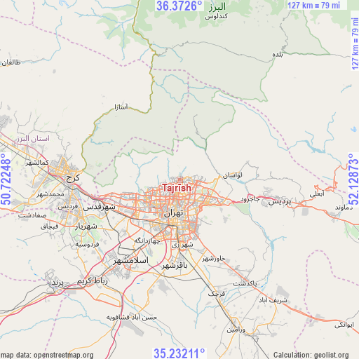
Tajrīsh GPS coordinates[2]
35° 48' 15.84" North, 51° 25' 32.16" East
| Map corner | latitude | longitude |
|---|---|---|
| Upper-left | 36.3726°, | 50.72248° |
| Center: | 35.8044°, | 51.4256° |
| Lower-right: | 35.23211°, | 52.12873° |
| Map W x H: | 126.8×126.8 km | = 78.8×78.8mi |
| max Lat: | 39.6482° ⇑32.9% North |
| Tajrīsh: | 35.8044° |
| min Lat: | ⇓67.1% South 25.2919° |
| min Long | Tajrīsh | max Long |
| 44.38416° | 51.4256° | 61.9965° |
| W 51.2%⇐ | ⇒48.8% E |
Elevation
Elevation of Tajrīsh is 1608 m = 5276 ft, and this is 559 m = 1834 ft above average elevation for this country.
| Max E: |
2564 m = 8412 ft | 22.4% |
| Tajrīsh | 1608 m 5276 ft | |
| Avg. | 1049 m = 3442 ft | |
Min E: |
-24 m = -79 ft | 77.6% |
See also: Iran elevation on elevation.city.
Geographical zone
Tajrīsh is located in North temperate zone (between Tropic of Cancer and the Arctic Circle). Distance of this Northern Tropic circle is 1375.2 km =854.5 mi to South.| Distance of | km | miles | from Tajrīsh |
|---|---|---|---|
| North Pole | 6026 | 3744.4 | to North |
| Arctic Circle | 3420.1 | 2125.2 | to North |
| Tropic Cancer | 1375.2 | 854.5 | to South |
| Equator | 3981.1 | 2473.7 | to South |


Nearby cities:
15 places around Tajrīsh: (largest is in red/bold)
• Eqbālīyeh
56.7 km =35.2 mi,  169°
169°
• Eslāmshahr
32.9 km =20.4 mi,  211°
211°
• Karaj
39.3 km =24.4 mi,  274°
274°
• Malārd
43.3 km =26.9 mi,  249°
249°
• Pākdasht
43.1 km =26.8 mi,  147°
147°
• Qarchak
43.9 km =27.3 mi,  162°
162°
• Rey
23.5 km =14.6 mi,  176°
176°
• Robāţ Karīm
47.2 km =29.3 mi,  221°
221°
• Shahr-e Qods
30 km =18.6 mi, 252°
• Shahrak-e Emām Ḩasan
35.9 km =22.3 mi,  191°
191°
• Shahre Jadide Andisheh
39.2 km =24.4 mi, 249°
• Shahrīār
36.9 km =22.9 mi,  244°
244°
• Sharīfābād
53 km =32.9 mi,  142°
142°
• Tehran
12.2 km =7.6 mi, 181°
• Ţāleb ābād
35 km =21.7 mi, 164°
Sources, notices
• [Note1] Compared only with cities in Iran existing in our database
• [Src1] Map data: © OpenStreetMap contributors (CC-BY-SA)
• [Src2] Other city data from geonames.org with taken over terms of usage.
• [Src3] Geographical zone / Annual Mean Temperature by Robert A. Rohde @ Wikipedia
