Shahrīār geodata
Shahrīār (Tehrān) is a seat of a second-order administrative division; located in Iran in Asia/Tehran (GMT+3.5) time zone. With population of 58,849 people, there are 110 cities with bigger population in this country. Compared to other cities in Iran, 64.4% of cities are located further ↓South; 52.4% of cities are located further →East and 50.8% of cities have higher elevation than Shahrīār. Note1


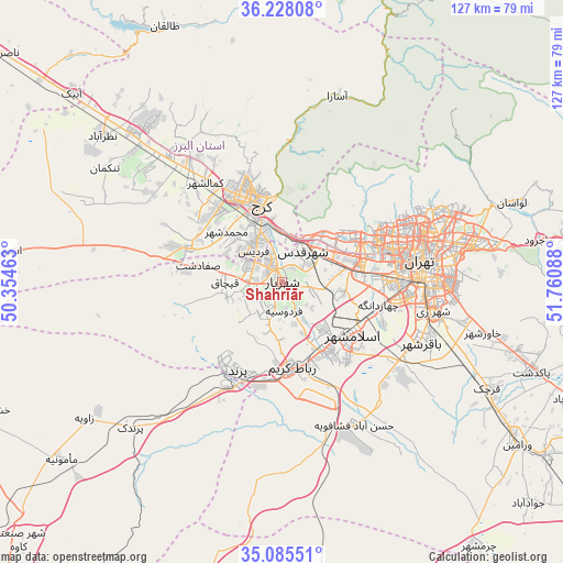
Shahrīār GPS coordinates[2]
35° 39' 31.824" North, 51° 3' 27.9" East
| Map corner | latitude | longitude |
|---|---|---|
| Upper-left | 36.22808°, | 50.35463° |
| Center: | 35.65884°, | 51.05775° |
| Lower-right: | 35.08551°, | 51.76088° |
| Map W x H: | 127×127 km | = 78.9×78.9mi |
| max Lat: | 39.6482° ⇑35.6% North |
| Shahrīār: | 35.65884° |
| min Lat: | ⇓64.4% South 25.2919° |
| min Long | Shahrīār | max Long |
| 44.38416° | 51.05775° | 61.9965° |
| W 47.6%⇐ | ⇒52.4% E |
Elevation
Elevation of Shahrīār is 1159 m = 3802 ft, and this is 110 m = 361 ft above average elevation for this country.
| Max E: |
2564 m = 8412 ft | 50.8% |
| Shahrīār | 1159 m 3802 ft | |
| Avg. | 1049 m = 3442 ft | |
Min E: |
-24 m = -79 ft | 49.2% |
See also: Shahrīār elevation on elevation.city.
Geographical zone
Shahrīār is located in North temperate zone (between Tropic of Cancer and the Arctic Circle). Distance of this Northern Tropic circle is 1359 km =844.4 mi to South.| Distance of | km | miles | from Shahrīār |
|---|---|---|---|
| North Pole | 6042.2 | 3754.4 | to North |
| Arctic Circle | 3436.3 | 2135.2 | to North |
| Tropic Cancer | 1359 | 844.4 | to South |
| Equator | 3964.9 | 2463.7 | to South |


Nearby cities:
15 places around Shahrīār: (largest is in red/bold)
• Eqbālīyeh
58.7 km =36.5 mi,  132°
132°
• Eslāmshahr
19.9 km =12.4 mi, 126°
• Hashtgerd
47.9 km =29.8 mi,  314°
314°
• Karaj
20.2 km =12.6 mi,  342°
342°
• Malārd
7.4 km =4.6 mi,  276°
276°
• Naz̧arābād
52.3 km =32.5 mi, 308°
• Qarchak
53.4 km =33.2 mi,  118°
118°
• Rey
35.3 km =21.9 mi,  101°
101°
• Robāţ Karīm
19.5 km =12.1 mi,  173°
173°
• Shahr-e Qods
8.4 km =5.2 mi,  33°
33°
• Shahrak-e Emām Ḩasan
32.2 km =20 mi, 126°
• Shahre Jadide Andisheh
4.2 km =2.6 mi,  304°
304°
• Tajrīsh
36.9 km =22.9 mi,  64°
64°
• Tehran
33.1 km =20.6 mi,  83°
83°
• Ţāleb ābād
46.3 km =28.8 mi,  112°
112°
Sources, notices
• [Note1] Compared only with cities in Iran existing in our database
• [Src1] Map data: © OpenStreetMap contributors (CC-BY-SA)
• [Src2] Other city data from geonames.org with taken over terms of usage.
• [Src3] Geographical zone / Annual Mean Temperature by Robert A. Rohde @ Wikipedia
