Ţāleb ābād geodata
Ţāleb ābād (Tehrān) is a populated place; located in Iran in Asia/Tehran (GMT+3.5) time zone. With population of 4,850 people, there are 213 cities with bigger population in this country. Compared to other cities in Iran, 63.3% of cities are located further ↓South; 54% of cities are located further ←West and 59.6% of cities have higher elevation than Ţāleb ābād. Note1


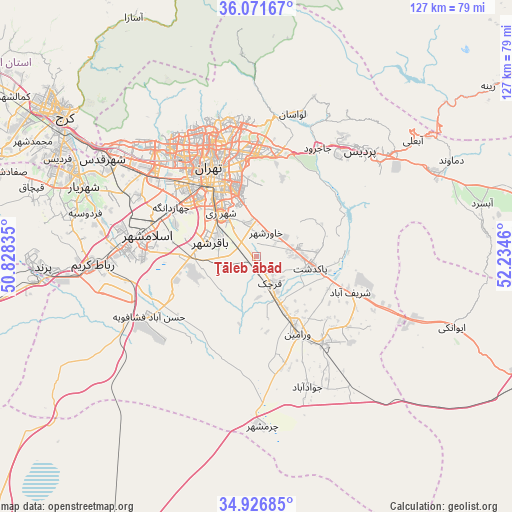
Ţāleb ābād GPS coordinates[2]
35° 30' 4.68" North, 51° 31' 53.292" East
| Map corner | latitude | longitude |
|---|---|---|
| Upper-left | 36.07167°, | 50.82835° |
| Center: | 35.5013°, | 51.53147° |
| Lower-right: | 34.92685°, | 52.2346° |
| Map W x H: | 127.3×127.3 km | = 79.1×79.1mi |
| max Lat: | 39.6482° ⇑36.7% North |
| Ţāleb ābād: | 35.5013° |
| min Lat: | ⇓63.3% South 25.2919° |
| min Long | Ţāleb ābād | max Long |
| 44.38416° | 51.53147° | 61.9965° |
| W 54%⇐ | ⇒46% E |
Elevation
Elevation of Ţāleb ābād is 990 m = 3248 ft, and this is 59 m = 194 ft below average elevation for this country.
| Max E: |
2564 m = 8412 ft | 59.6% |
| Avg. | 1049 m = 3442 ft | |
| Ţāleb ābād | 990 m = 3248 ft | |
Min E: |
-24 m = -79 ft | 40.4% |
See also: Iran elevation on elevation.city.
Geographical zone
Ţāleb ābād is located in North temperate zone (between Tropic of Cancer and the Arctic Circle). Distance of this Northern Tropic circle is 1341.5 km =833.6 mi to South.| Distance of | km | miles | from Ţāleb ābād |
|---|---|---|---|
| North Pole | 6059.7 | 3765.3 | to North |
| Arctic Circle | 3453.8 | 2146.1 | to North |
| Tropic Cancer | 1341.5 | 833.6 | to South |
| Equator | 3947.4 | 2452.8 | to South |


Nearby cities:
15 places around Ţāleb ābād: (largest is in red/bold)
• Eqbālīyeh
22.1 km =13.7 mi,  178°
178°
• Eslāmshahr
27.4 km =17 mi,  281°
281°
• Pākdasht
14 km =8.7 mi,  100°
100°
• Pīshvā
27.8 km =17.3 mi,  140°
140°
• Qarchak
9 km =5.6 mi,  153°
153°
• Rey
13.2 km =8.2 mi,  321°
321°
• Robāţ Karīm
40.7 km =25.3 mi,  267°
267°
• Shahr-e Qods
45.4 km =28.2 mi,  302°
302°
• Shahrak-e Emām Ḩasan
16.9 km =10.5 mi, 265°
• Shahre Jadide Andisheh
50.4 km =31.3 mi,  293°
293°
• Shahrīār
46.3 km =28.8 mi, 292°
• Sharīfābād
24.4 km =15.2 mi,  109°
109°
• Tajrīsh
35 km =21.7 mi,  344°
344°
• Tehran
23.7 km =14.7 mi, 335°
• Varāmīn
22.2 km =13.8 mi, 152°
Sources, notices
• [Note1] Compared only with cities in Iran existing in our database
• [Src1] Map data: © OpenStreetMap contributors (CC-BY-SA)
• [Src2] Other city data from geonames.org with taken over terms of usage.
• [Src3] Geographical zone / Annual Mean Temperature by Robert A. Rohde @ Wikipedia
