Mahdishahr geodata
Mahdishahr (Semnan) is a seat of a second-order administrative division; located in Iran in Asia/Tehran (GMT+3.5) time zone. With population of 21,000 people, there are 191 cities with bigger population in this country. Compared to other cities in Iran, 65.5% of cities are located further ↓South; 68.7% of cities are located further ←West and 80.5% of cities have lower elevation than Mahdishahr. Note1


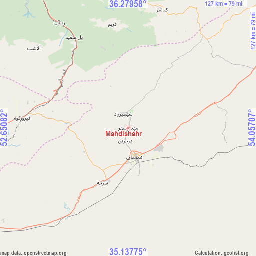
Mahdishahr GPS coordinates[2]
35° 42' 38.556" North, 53° 21' 14.184" East
| Map corner | latitude | longitude |
|---|---|---|
| Upper-left | 36.27958°, | 52.65082° |
| Center: | 35.71071°, | 53.35394° |
| Lower-right: | 35.13775°, | 54.05707° |
| Map W x H: | 127×127 km | = 78.9×78.9mi |
| max Lat: | 39.6482° ⇑34.5% North |
| Mahdishahr: | 35.71071° |
| min Lat: | ⇓65.5% South 25.2919° |
| min Long | Mahdishahr | max Long |
| 44.38416° | 53.35394° | 61.9965° |
| W 68.7%⇐ | ⇒31.3% E |
Elevation
Elevation of Mahdishahr is 1661 m = 5449 ft, and this is 612 m = 2008 ft above average elevation for this country.
| Max E: |
2564 m = 8412 ft | 19.5% |
| Mahdishahr | 1661 m 5449 ft | |
| Avg. | 1049 m = 3442 ft | |
Min E: |
-24 m = -79 ft | 80.5% |
See also: Iran elevation on elevation.city.
Geographical zone
Mahdishahr is located in North temperate zone (between Tropic of Cancer and the Arctic Circle). Distance of this Northern Tropic circle is 1364.7 km =848 mi to South.| Distance of | km | miles | from Mahdishahr |
|---|---|---|---|
| North Pole | 6036.4 | 3750.8 | to North |
| Arctic Circle | 3430.5 | 2131.6 | to North |
| Tropic Cancer | 1364.7 | 848 | to South |
| Equator | 3970.7 | 2467.3 | to South |


Nearby cities:
15 places around Mahdishahr: (largest is in red/bold)
• Behshahr
110.6 km =68.7 mi,  9°
9°
• Dāmghān
102.5 km =63.7 mi,  60°
60°
• Fīrūzkūh
52.9 km =32.9 mi,  275°
275°
• Garmsār
106.8 km =66.4 mi,  239°
239°
• Jūybār
110.8 km =68.8 mi,  339°
339°
• Nekā
104.6 km =65 mi,  357°
357°
• Pol-e Sefīd
52.7 km =32.7 mi,  329°
329°
• Qā’em Shahr
95.3 km =59.2 mi, 334°
• Sari
98.4 km =61.1 mi, 344°
• Semnan
15.3 km =9.5 mi,  166°
166°
• Soleh Bon
71.9 km =44.7 mi, 275°
• Sorkheh
30.3 km =18.8 mi,  204°
204°
• Sūrak
99.2 km =61.6 mi,  352°
352°
• Ārādān
93.2 km =57.9 mi, 236°
• Īstgāh-e Rāh Āhan-e Garmsār
108.4 km =67.4 mi, 240°
Sources, notices
• [Note1] Compared only with cities in Iran existing in our database
• [Src1] Map data: © OpenStreetMap contributors (CC-BY-SA)
• [Src2] Other city data from geonames.org with taken over terms of usage.
• [Src3] Geographical zone / Annual Mean Temperature by Robert A. Rohde @ Wikipedia
