Naţanz geodata
Naţanz (Isfahan) is a seat of a second-order administrative division; located in Iran in Asia/Tehran (GMT+3.5) time zone. In our database, there are 232 cities with bigger population. Compared to other cities in Iran, 57.8% of cities are located further ↑North; 58.3% of cities are located further ←West and 79.4% of cities have lower elevation than Naţanz. Note1


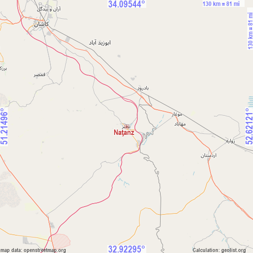
Naţanz GPS coordinates[2]
33° 30' 40.248" North, 51° 55' 5.088" East
| Map corner | latitude | longitude |
|---|---|---|
| Upper-left | 34.09544°, | 51.21496° |
| Center: | 33.51118°, | 51.91808° |
| Lower-right: | 32.92295°, | 52.62121° |
| Map W x H: | 130.4×130.4 km | = 81×81mi |
| max Lat: | 39.6482° ⇑57.8% North |
| Naţanz: | 33.51118° |
| min Lat: | ⇓42.2% South 25.2919° |
| min Long | Naţanz | max Long |
| 44.38416° | 51.91808° | 61.9965° |
| W 58.3%⇐ | ⇒41.7% E |
Elevation
Elevation of Naţanz is 1637 m = 5371 ft, and this is 588 m = 1929 ft above average elevation for this country.
| Max E: |
2564 m = 8412 ft | 20.6% |
| Naţanz | 1637 m 5371 ft | |
| Avg. | 1049 m = 3442 ft | |
Min E: |
-24 m = -79 ft | 79.4% |
See also: Iran elevation on elevation.city.
Geographical zone
Naţanz is located in North temperate zone (between Tropic of Cancer and the Arctic Circle). Distance of this Northern Tropic circle is 1120.2 km =696.1 mi to South.| Distance of | km | miles | from Naţanz |
|---|---|---|---|
| North Pole | 6281 | 3902.8 | to North |
| Arctic Circle | 3675.1 | 2283.6 | to North |
| Tropic Cancer | 1120.2 | 696.1 | to South |
| Equator | 3726.1 | 2315.3 | to South |


Nearby cities:
15 places around Naţanz: (largest is in red/bold)
• Abrīsham
110.9 km =68.9 mi,  196°
196°
• Ardestān
44.5 km =27.7 mi,  109°
109°
• Dorcheh Pīāz
105.2 km =65.4 mi, 198°
• Dowlatābād
81.8 km =50.8 mi,  194°
194°
• Falāvarjān
112.9 km =70.2 mi, 199°
• Isfahan
98.1 km =61 mi, 193°
• Kelīshād va Sūdarjān
112.8 km =70.1 mi, 198°
• Khomeynī Shahr
98.5 km =61.2 mi, 201°
• Kāshān
69.7 km =43.3 mi,  320°
320°
• Najafābād
110.2 km =68.5 mi,  207°
207°
• Qahderījān
112.5 km =69.9 mi, 202°
• Rehnān
96.7 km =60.1 mi, 197°
• Shāhīn Shahr
80.2 km =49.8 mi, 205°
• Tīrān
114.7 km =71.3 mi,  218°
218°
• Ārān Bīdgol
72.9 km =45.3 mi,  326°
326°
Sources, notices
• [Note1] Compared only with cities in Iran existing in our database
• [Src1] Map data: © OpenStreetMap contributors (CC-BY-SA)
• [Src2] Other city data from geonames.org with taken over terms of usage.
• [Src3] Geographical zone / Annual Mean Temperature by Robert A. Rohde @ Wikipedia
