Bandar-e Gaz geodata
Bandar-e Gaz (Golestan) is a seat of a second-order administrative division; located in Iran in Asia/Tehran (GMT+3.5) time zone. In our database, there are 232 cities with bigger population. Compared to other cities in Iran, 80% of cities are located further ↓South; 70.7% of cities are located further ←West and 98.4% of cities have higher elevation than Bandar-e Gaz. Note1


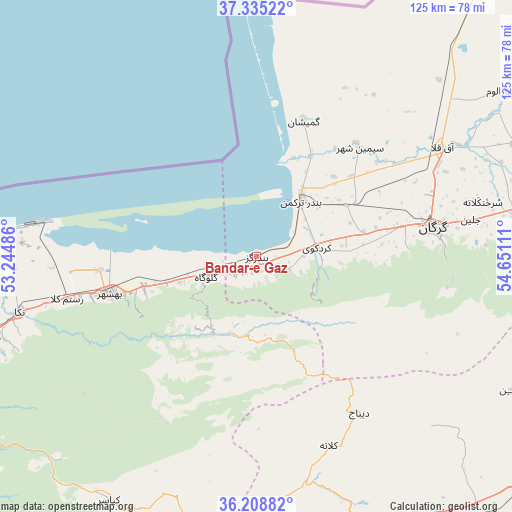
Bandar-e Gaz GPS coordinates[2]
36° 46' 26.724" North, 53° 56' 52.728" East
| Map corner | latitude | longitude |
|---|---|---|
| Upper-left | 37.33522°, | 53.24486° |
| Center: | 36.77409°, | 53.94798° |
| Lower-right: | 36.20882°, | 54.65111° |
| Map W x H: | 125.2×125.2 km | = 77.8×77.8mi |
| max Lat: | 39.6482° ⇑20% North |
| Bandar-e Gaz: | 36.77409° |
| min Lat: | ⇓80% South 25.2919° |
| min Long | Bandar-e Gaz | max Long |
| 44.38416° | 53.94798° | 61.9965° |
| W 70.7%⇐ | ⇒29.3% E |
Elevation
Elevation of Bandar-e Gaz is -19 m = -62 ft, and this is 1068 m = 3504 ft below average elevation for this country.
| Max E: |
2564 m = 8412 ft | 98.4% |
| Avg. | 1049 m = 3442 ft | |
| Bandar-e Gaz | -19 m = -62 ft | |
Min E: |
-24 m = -79 ft | 1.6% |
See also: Iran elevation on elevation.city.
Geographical zone
Bandar-e Gaz is located in North temperate zone (between Tropic of Cancer and the Arctic Circle). Distance of this Northern Tropic circle is 1483 km =921.5 mi to South.| Distance of | km | miles | from Bandar-e Gaz |
|---|---|---|---|
| North Pole | 5918.2 | 3677.4 | to North |
| Arctic Circle | 3312.3 | 2058.2 | to North |
| Tropic Cancer | 1483 | 921.5 | to South |
| Equator | 4088.9 | 2540.7 | to South |


Nearby cities:
15 places around Bandar-e Gaz: (largest is in red/bold)
• Aliabad-e Katul
83.2 km =51.7 mi,  79°
79°
• Bandar-e Torkaman
17.9 km =11.1 mi,  37°
37°
• Behshahr
36.4 km =22.6 mi,  255°
255°
• Dāmghān
76.1 km =47.3 mi,  152°
152°
• Galūgāh
13.4 km =8.3 mi,  247°
247°
• Gomīshān
35 km =21.7 mi,  19°
19°
• Gorgān
44.8 km =27.8 mi, 80°
• Jūybār
93.5 km =58.1 mi, 260°
• Kord Kūy
14.8 km =9.2 mi, 81°
• Nekā
59.4 km =36.9 mi, 256°
• Qarnābād
57.6 km =35.8 mi, 84°
• Qā’em Shahr
99.8 km =62 mi, 250°
• Sari
82.6 km =51.3 mi, 253°
• Sūrak
69 km =42.9 mi, 253°
• Āq Qalā
52.4 km =32.6 mi,  59°
59°
Sources, notices
• [Note1] Compared only with cities in Iran existing in our database
• [Src1] Map data: © OpenStreetMap contributors (CC-BY-SA)
• [Src2] Other city data from geonames.org with taken over terms of usage.
• [Src3] Geographical zone / Annual Mean Temperature by Robert A. Rohde @ Wikipedia
