Gorgān geodata
Gorgān (Golestan) is a seat of a first-order administrative division; located in Iran in Asia/Tehran (GMT+3.5) time zone. With population of 244,937 people, there are 31 cities with bigger population in this country. Compared to other cities in Iran, 81.2% of cities are located further ↓South; 75.1% of cities are located further ←West and 81.4% of cities have higher elevation than Gorgān. Note1


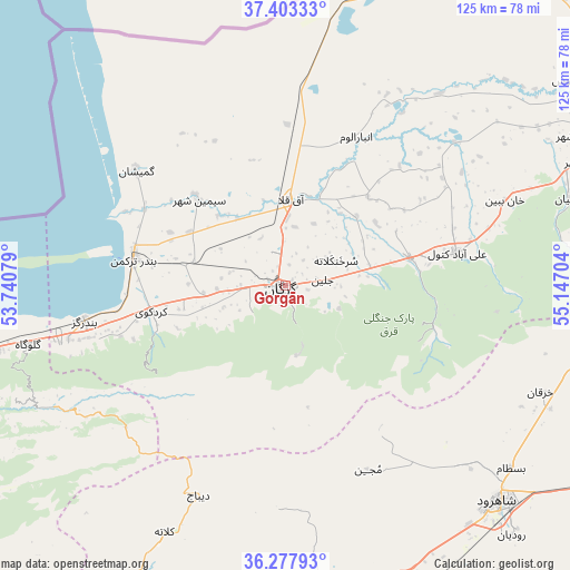
Gorgān GPS coordinates[2]
36° 50' 33.72" North, 54° 26' 38.076" East
| Map corner | latitude | longitude |
|---|---|---|
| Upper-left | 37.40333°, | 53.74079° |
| Center: | 36.8427°, | 54.44391° |
| Lower-right: | 36.27793°, | 55.14704° |
| Map W x H: | 125.1×125.1 km | = 77.7×77.7mi |
| max Lat: | 39.6482° ⇑18.8% North |
| Gorgān: | 36.8427° |
| min Lat: | ⇓81.2% South 25.2919° |
| min Long | Gorgān | max Long |
| 44.38416° | 54.44391° | 61.9965° |
| W 75.1%⇐ | ⇒24.9% E |
Elevation
Elevation of Gorgān is 140 m = 459 ft, and this is 909 m = 2982 ft below average elevation for this country.
| Max E: |
2564 m = 8412 ft | 81.4% |
| Avg. | 1049 m = 3442 ft | |
| Gorgān | 140 m = 459 ft | |
Min E: |
-24 m = -79 ft | 18.6% |
See also: Gorgān elevation on elevation.city.
Geographical zone
Gorgān is located in North temperate zone (between Tropic of Cancer and the Arctic Circle). Distance of this Northern Tropic circle is 1490.6 km =926.2 mi to South.| Distance of | km | miles | from Gorgān |
|---|---|---|---|
| North Pole | 5910.5 | 3672.6 | to North |
| Arctic Circle | 3304.6 | 2053.4 | to North |
| Tropic Cancer | 1490.6 | 926.2 | to South |
| Equator | 4096.5 | 2545.4 | to South |


Nearby cities:
15 places around Gorgān: (largest is in red/bold)
• Aliabad-e Katul
38.4 km =23.9 mi,  78°
78°
• Bandar-e Gaz
44.8 km =27.8 mi,  260°
260°
• Bandar-e Torkaman
33.7 km =20.9 mi,  281°
281°
• Behshahr
81.1 km =50.4 mi, 258°
• Dāmghān
75.6 km =47 mi,  186°
186°
• Galūgāh
58 km =36 mi, 257°
• Gomīshān
41.4 km =25.7 mi,  307°
307°
• Gonbad-e Kāvūs
78.6 km =48.8 mi,  54°
54°
• Kord Kūy
30 km =18.6 mi, 259°
• Qarnābād
13.4 km =8.3 mi,  99°
99°
• Rāmīān
64.9 km =40.3 mi,  72°
72°
• Shahrud
67 km =41.6 mi,  134°
134°
• Āq Qalā
19.1 km =11.9 mi,  2°
2°
• Āq Qāyeh
79.6 km =49.5 mi, 52°
• Āzādshahr
70.1 km =43.6 mi, 67°
Sources, notices
• [Note1] Compared only with cities in Iran existing in our database
• [Src1] Map data: © OpenStreetMap contributors (CC-BY-SA)
• [Src2] Other city data from geonames.org with taken over terms of usage.
• [Src3] Geographical zone / Annual Mean Temperature by Robert A. Rohde @ Wikipedia
