Qarnābād geodata
Qarnābād (Golestan) is a populated place; located in Iran in Asia/Tehran (GMT+3.5) time zone. With population of 1,961 people, there are 220 cities with bigger population in this country. Compared to other cities in Iran, 81% of cities are located further ↓South; 75.7% of cities are located further ←West and 77.8% of cities have higher elevation than Qarnābād. Note1


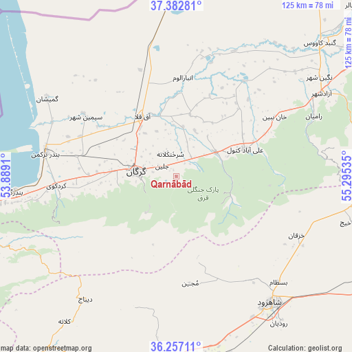
Qarnābād GPS coordinates[2]
36° 49' 19.308" North, 54° 35' 31.992" East
| Map corner | latitude | longitude |
|---|---|---|
| Upper-left | 37.38281°, | 53.8891° |
| Center: | 36.82203°, | 54.59222° |
| Lower-right: | 36.25711°, | 55.29535° |
| Map W x H: | 125.2×125.2 km | = 77.8×77.8mi |
| max Lat: | 39.6482° ⇑19% North |
| Qarnābād: | 36.82203° |
| min Lat: | ⇓81% South 25.2919° |
| min Long | Qarnābād | max Long |
| 44.38416° | 54.59222° | 61.9965° |
| W 75.7%⇐ | ⇒24.3% E |
Elevation
Elevation of Qarnābād is 262 m = 860 ft, and this is 787 m = 2582 ft below average elevation for this country.
| Max E: |
2564 m = 8412 ft | 77.8% |
| Avg. | 1049 m = 3442 ft | |
| Qarnābād | 262 m = 860 ft | |
Min E: |
-24 m = -79 ft | 22.2% |
See also: Iran elevation on elevation.city.
Geographical zone
Qarnābād is located in North temperate zone (between Tropic of Cancer and the Arctic Circle). Distance of this Northern Tropic circle is 1488.3 km =924.8 mi to South.| Distance of | km | miles | from Qarnābād |
|---|---|---|---|
| North Pole | 5912.8 | 3674 | to North |
| Arctic Circle | 3306.9 | 2054.8 | to North |
| Tropic Cancer | 1488.3 | 924.8 | to South |
| Equator | 4094.2 | 2544 | to South |


Nearby cities:
15 places around Qarnābād: (largest is in red/bold)
• Aliabad-e Katul
26.4 km =16.4 mi,  68°
68°
• Bandar-e Gaz
57.6 km =35.8 mi,  264°
264°
• Bandar-e Torkaman
47.1 km =29.3 mi,  280°
280°
• Dāmghān
76.1 km =47.3 mi,  197°
197°
• Galūgāh
70.6 km =43.9 mi, 261°
• Gomīshān
53.6 km =33.3 mi,  301°
301°
• Gonbad-e Kāvūs
69.8 km =43.4 mi,  47°
47°
• Gorgān
13.4 km =8.3 mi, 279°
• Kord Kūy
42.9 km =26.7 mi,  265°
265°
• Mīnūdasht
82.8 km =51.4 mi,  56°
56°
• Rāmīān
53.4 km =33.2 mi, 66°
• Shahrud
56.5 km =35.1 mi,  142°
142°
• Āq Qalā
24.6 km =15.3 mi,  330°
330°
• Āq Qāyeh
71.2 km =44.2 mi,  44°
44°
• Āzādshahr
59.3 km =36.8 mi, 60°
Sources, notices
• [Note1] Compared only with cities in Iran existing in our database
• [Src1] Map data: © OpenStreetMap contributors (CC-BY-SA)
• [Src2] Other city data from geonames.org with taken over terms of usage.
• [Src3] Geographical zone / Annual Mean Temperature by Robert A. Rohde @ Wikipedia
