Āq Qalā geodata
Āq Qalā (Golestan) is a seat of a second-order administrative division; located in Iran in Asia/Tehran (GMT+3.5) time zone. In our database, there are 232 cities with bigger population. Compared to other cities in Iran, 83.4% of cities are located further ↓South; 75.3% of cities are located further ←West and 97.1% of cities have higher elevation than Āq Qalā. Note1


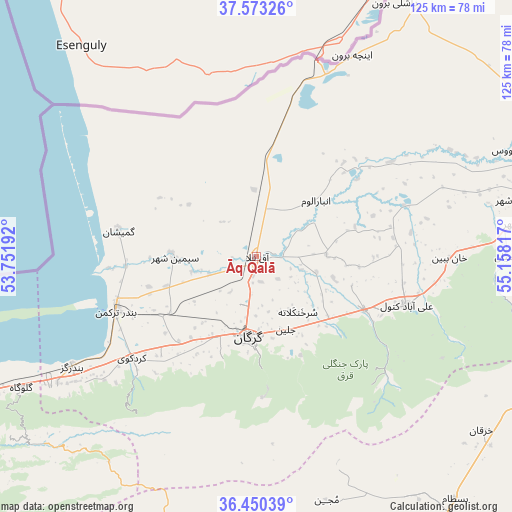
Āq Qalā GPS coordinates[2]
37° 0' 50.04" North, 54° 27' 18.144" East
| Map corner | latitude | longitude |
|---|---|---|
| Upper-left | 37.57326°, | 53.75192° |
| Center: | 37.0139°, | 54.45504° |
| Lower-right: | 36.45039°, | 55.15817° |
| Map W x H: | 124.9×124.9 km | = 77.6×77.6mi |
| max Lat: | 39.6482° ⇑16.6% North |
| Āq Qalā: | 37.0139° |
| min Lat: | ⇓83.4% South 25.2919° |
| min Long | Āq Qalā | max Long |
| 44.38416° | 54.45504° | 61.9965° |
| W 75.3%⇐ | ⇒24.7% E |
Elevation
Elevation of Āq Qalā is -13 m = -43 ft, and this is 1062 m = 3484 ft below average elevation for this country.
| Max E: |
2564 m = 8412 ft | 97.1% |
| Avg. | 1049 m = 3442 ft | |
| Āq Qalā | -13 m = -43 ft | |
Min E: |
-24 m = -79 ft | 2.9% |
See also: Iran elevation on elevation.city.
Geographical zone
Āq Qalā is located in North temperate zone (between Tropic of Cancer and the Arctic Circle). Distance of this Northern Tropic circle is 1509.6 km =938 mi to South.| Distance of | km | miles | from Āq Qalā |
|---|---|---|---|
| North Pole | 5891.5 | 3660.8 | to North |
| Arctic Circle | 3285.6 | 2041.6 | to North |
| Tropic Cancer | 1509.6 | 938 | to South |
| Equator | 4115.6 | 2557.3 | to South |


Nearby cities:
15 places around Āq Qalā: (largest is in red/bold)
• Aliabad-e Katul
38.4 km =23.9 mi,  107°
107°
• Bandar-e Gaz
52.4 km =32.6 mi,  239°
239°
• Bandar-e Torkaman
36.3 km =22.6 mi,  249°
249°
• Behshahr
87.9 km =54.6 mi, 245°
• Galūgāh
65.7 km =40.8 mi, 240°
• Gomīshān
34.2 km =21.3 mi,  280°
280°
• Gonbad-e Kāvūs
68.4 km =42.5 mi,  67°
67°
• Gorgān
19.1 km =11.9 mi,  182°
182°
• Kord Kūy
39.1 km =24.3 mi,  231°
231°
• Mīnūdasht
84.8 km =52.7 mi, 73°
• Qarnābād
24.6 km =15.3 mi,  150°
150°
• Rāmīān
60.9 km =37.8 mi,  89°
89°
• Shahrud
80.9 km =50.3 mi,  144°
144°
• Āq Qāyeh
68.8 km =42.8 mi, 65°
• Āzādshahr
64.2 km =39.9 mi,  82°
82°
Sources, notices
• [Note1] Compared only with cities in Iran existing in our database
• [Src1] Map data: © OpenStreetMap contributors (CC-BY-SA)
• [Src2] Other city data from geonames.org with taken over terms of usage.
• [Src3] Geographical zone / Annual Mean Temperature by Robert A. Rohde @ Wikipedia
