Dāmghān geodata
Dāmghān (Semnan) is a seat of a second-order administrative division; located in Iran in Asia/Tehran (GMT+3.5) time zone. With population of 67,694 people, there are 99 cities with bigger population in this country. Compared to other cities in Iran, 70.1% of cities are located further ↓South; 73.7% of cities are located further ←West and 51% of cities have higher elevation than Dāmghān. Note1


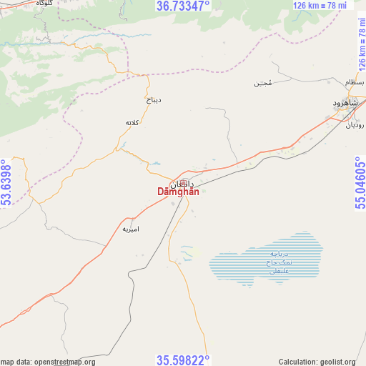
Dāmghān GPS coordinates[2]
36° 10' 4.44" North, 54° 20' 34.512" East
| Map corner | latitude | longitude |
|---|---|---|
| Upper-left | 36.73347°, | 53.6398° |
| Center: | 36.1679°, | 54.34292° |
| Lower-right: | 35.59822°, | 55.04605° |
| Map W x H: | 126.2×126.2 km | = 78.4×78.4mi |
| max Lat: | 39.6482° ⇑29.9% North |
| Dāmghān: | 36.1679° |
| min Lat: | ⇓70.1% South 25.2919° |
| min Long | Dāmghān | max Long |
| 44.38416° | 54.34292° | 61.9965° |
| W 73.7%⇐ | ⇒26.3% E |
Elevation
Elevation of Dāmghān is 1154 m = 3786 ft, and this is 105 m = 344 ft above average elevation for this country.
| Max E: |
2564 m = 8412 ft | 51% |
| Dāmghān | 1154 m 3786 ft | |
| Avg. | 1049 m = 3442 ft | |
Min E: |
-24 m = -79 ft | 49% |
See also: Dāmghān elevation on elevation.city.
Geographical zone
Dāmghān is located in North temperate zone (between Tropic of Cancer and the Arctic Circle). Distance of this Northern Tropic circle is 1415.6 km =879.6 mi to South.| Distance of | km | miles | from Dāmghān |
|---|---|---|---|
| North Pole | 5985.6 | 3719.3 | to North |
| Arctic Circle | 3379.7 | 2100 | to North |
| Tropic Cancer | 1415.6 | 879.6 | to South |
| Equator | 4021.5 | 2498.8 | to South |


Nearby cities:
15 places around Dāmghān: (largest is in red/bold)
• Aliabad-e Katul
94.9 km =59 mi,  29°
29°
• Bandar-e Gaz
76.1 km =47.3 mi,  332°
332°
• Bandar-e Torkaman
85.1 km =52.9 mi,  343°
343°
• Behshahr
91.6 km =56.9 mi,  309°
309°
• Galūgāh
78.4 km =48.7 mi,  322°
322°
• Gomīshān
103.3 km =64.2 mi,  346°
346°
• Gorgān
75.6 km =47 mi,  6°
6°
• Kord Kūy
72.5 km =45 mi, 343°
• Mahdishahr
102.5 km =63.7 mi,  240°
240°
• Nekā
107.7 km =66.9 mi,  299°
299°
• Qarnābād
76.1 km =47.3 mi,  17°
17°
• Semnan
108 km =67.1 mi,  232°
232°
• Shahrud
63.2 km =39.3 mi,  63°
63°
• Sūrak
112.2 km =69.7 mi, 295°
• Āq Qalā
94.6 km =58.8 mi, 6°
Sources, notices
• [Note1] Compared only with cities in Iran existing in our database
• [Src1] Map data: © OpenStreetMap contributors (CC-BY-SA)
• [Src2] Other city data from geonames.org with taken over terms of usage.
• [Src3] Geographical zone / Annual Mean Temperature by Robert A. Rohde @ Wikipedia
