Linera geodata
Linera (Sicily) is a populated place; located in Italy in Europe/Rome (GMT+2) time zone. With population of 2,757 people, there are 3261 cities with bigger population in this country. Compared to other cities in Italy, 98.2% of cities are located further ↑North; 88.4% of cities are located further ←West and 60% of cities have lower elevation than Linera. Note1


Linera GPS coordinates[2]
37° 39' 49.68" North, 15° 8' 11.508" East
| Map corner | latitude | longitude |
|---|---|---|
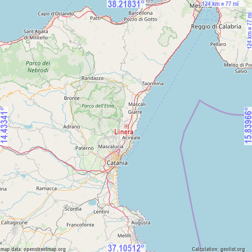
| Upper-left | 38.21831°, | 14.43341° |
| Center: | 37.6638°, | 15.13653° |
| Lower-right: | 37.10512°, | 15.83966° |
| Map W x H: | 123.8×123.8 km | = 76.9×76.9mi |
| max Lat: | 47.04031° ⇑98.2% North |
| Linera: | 37.6638° |
| min Lat: | ⇓1.8% South 35.50142° |
| min Long | Linera | max Long |
| 6.69888° | 15.13653° | 18.48682° |
| W 88.4%⇐ | ⇒11.6% E |
Elevation
Elevation of Linera is 299 m = 981 ft, and this is 7.7 m = 25 ft below average elevation for this country.
| Max E: |
2085 m = 6841 ft | 40% |
| Avg. | 306.7 m = 1006 ft | |
| Linera | 299 m = 981 ft | |
Min E: |
-4 m = -13 ft | 60% |
See also: Italy elevation on elevation.city.
Geographical zone
Linera is located in North temperate zone (between Tropic of Cancer and the Arctic Circle). Distance of this Northern Tropic circle is 1581.9 km =982.9 mi to South.| Distance of | km | miles | from Linera |
|---|---|---|---|
| North Pole | 5819.2 | 3615.9 | to North |
| Arctic Circle | 3213.4 | 1996.7 | to North |
| Tropic Cancer | 1581.9 | 982.9 | to South |
| Equator | 4187.8 | 2602.2 | to South |


Nearby cities:
15 places around Linera: (largest is in red/bold)
• Aci Bonaccorsi
7.9 km =4.9 mi,  198°
198°
• Aci Catena
6.4 km =4 mi,  175°
175°
• Aci Sant'Antonio
6.6 km =4.1 mi,  190°
190°
• Acireale
6.6 km =4.1 mi,  157°
157°
• Carruba
5.4 km =3.4 mi,  56°
56°
• Giarre
7.8 km =4.8 mi,  30°
30°
• Lavinaio-Monterosso
3.8 km =2.4 mi,  227°
227°
• Milo
7 km =4.3 mi,  344°
344°
• Monterosso
4.6 km =2.9 mi,  239°
239°
• Pennisi
1.9 km =1.2 mi,  214°
214°
• Santa Maria la Stella
4.7 km =2.9 mi, 197°
• Santa Venerina
3 km =1.9 mi,  3°
3°
• Trecastagni
7.5 km =4.7 mi,  223°
223°
• Viagrande
6.8 km =4.2 mi, 209°
• Zafferana Etnea
3.3 km =2.1 mi,  300°
300°
Sources, notices
• [Note1] Compared only with cities in Italy existing in our database
• [Src1] Map data: © OpenStreetMap contributors (CC-BY-SA)
• [Src2] Other city data from geonames.org with taken over terms of usage.
• [Src3] Geographical zone / Annual Mean Temperature by Robert A. Rohde @ Wikipedia
