Buggerru geodata
Buggerru (Sardinia) is a seat of a third-order administrative division; located in Italy in Europe/Rome (GMT+2) time zone. With population of 1,037 people, there are 6519 cities with bigger population in this country. Compared to other cities in Italy, 90.8% of cities are located further ↑North; 89.1% of cities are located further →East and 83.7% of cities have higher elevation than Buggerru. Note1


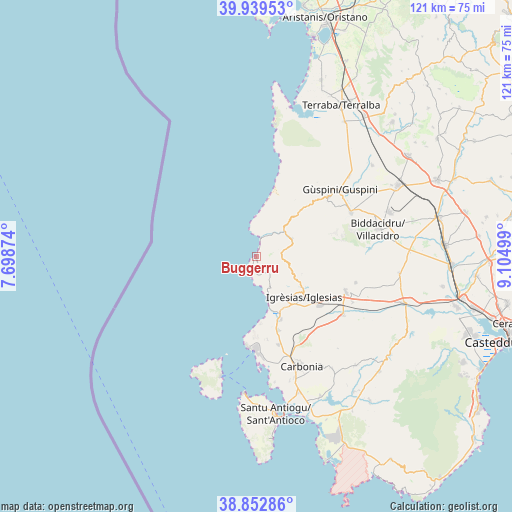
Buggerru GPS coordinates[2]
39° 23' 53.916" North, 8° 24' 6.696" East
| Map corner | latitude | longitude |
|---|---|---|
| Upper-left | 39.93953°, | 7.69874° |
| Center: | 39.39831°, | 8.40186° |
| Lower-right: | 38.85286°, | 9.10499° |
| Map W x H: | 120.8×120.8 km | = 75.1×75.1mi |
| max Lat: | 47.04031° ⇑90.8% North |
| Buggerru: | 39.39831° |
| min Lat: | ⇓9.2% South 35.50142° |
| min Long | Buggerru | max Long |
| 6.69888° | 8.40186° | 18.48682° |
| W 10.9%⇐ | ⇒89.1% E |
Elevation
Elevation of Buggerru is 35 m = 115 ft, and this is 271.7 m = 891 ft below average elevation for this country.
| Max E: |
2085 m = 6841 ft | 83.7% |
| Avg. | 306.7 m = 1006 ft | |
| Buggerru | 35 m = 115 ft | |
Min E: |
-4 m = -13 ft | 16.3% |
See also: Italy elevation on elevation.city.
Geographical zone
Buggerru is located in North temperate zone (between Tropic of Cancer and the Arctic Circle). Distance of this Northern Tropic circle is 1774.8 km =1102.8 mi to South.| Distance of | km | miles | from Buggerru |
|---|---|---|---|
| North Pole | 5626.4 | 3496.1 | to North |
| Arctic Circle | 3020.5 | 1876.9 | to North |
| Tropic Cancer | 1774.8 | 1102.8 | to South |
| Equator | 4380.7 | 2722 | to South |


Nearby cities:
15 places around Buggerru: (largest is in red/bold)
• Arbus
22.1 km =13.7 mi,  50°
50°
• Bacu Abis
18.1 km =11.2 mi,  162°
162°
• Barbusi
23.6 km =14.7 mi, 157°
• Cortoghiana
21.5 km =13.4 mi,  165°
165°
• Domusnovas
22.8 km =14.2 mi,  111°
111°
• Fluminimaggiore
9.4 km =5.8 mi,  61°
61°
• Gonnesa
15.9 km =9.9 mi, 158°
• Gonnosfanadiga
24.8 km =15.4 mi, 64°
• Iglesias
15.3 km =9.5 mi,  130°
130°
• Musei
25.1 km =15.6 mi,  115°
115°
• Nebida
9.9 km =6.2 mi, 161°
• Nuraxi Figus
19.7 km =12.2 mi, 172°
• Paringianu
25 km =15.5 mi, 174°
• Portoscuso
21.3 km =13.2 mi,  184°
184°
• Villamassargia
24.7 km =15.3 mi, 123°
Sources, notices
• [Note1] Compared only with cities in Italy existing in our database
• [Src1] Map data: © OpenStreetMap contributors (CC-BY-SA)
• [Src2] Other city data from geonames.org with taken over terms of usage.
• [Src3] Geographical zone / Annual Mean Temperature by Robert A. Rohde @ Wikipedia
