San Vito geodata
San Vito (Sardinia) is a seat of a third-order administrative division; located in Italy in Europe/Rome (GMT+2) time zone. With population of 3,396 people, there are 2761 cities with bigger population in this country. Compared to other cities in Italy, 90.6% of cities are located further ↑North; 72.8% of cities are located further →East and 90.6% of cities have higher elevation than San Vito. Note1


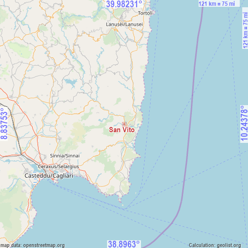
San Vito GPS coordinates[2]
39° 26' 29.112" North, 9° 32' 26.34" East
| Map corner | latitude | longitude |
|---|---|---|
| Upper-left | 39.98231°, | 8.83753° |
| Center: | 39.44142°, | 9.54065° |
| Lower-right: | 38.8963°, | 10.24378° |
| Map W x H: | 120.8×120.8 km | = 75.1×75.1mi |
| max Lat: | 47.04031° ⇑90.6% North |
| San Vito: | 39.44142° |
| min Lat: | ⇓9.4% South 35.50142° |
| min Long | San Vito | max Long |
| 6.69888° | 9.54065° | 18.48682° |
| W 27.2%⇐ | ⇒72.8% E |
Elevation
Elevation of San Vito is 17 m = 56 ft, and this is 289.7 m = 950 ft below average elevation for this country.
| Max E: |
2085 m = 6841 ft | 90.6% |
| Avg. | 306.7 m = 1006 ft | |
| San Vito | 17 m = 56 ft | |
Min E: |
-4 m = -13 ft | 9.4% |
See also: Italy elevation on elevation.city.
Geographical zone
San Vito is located in North temperate zone (between Tropic of Cancer and the Arctic Circle). Distance of this Northern Tropic circle is 1779.6 km =1105.8 mi to South.| Distance of | km | miles | from San Vito |
|---|---|---|---|
| North Pole | 5621.6 | 3493.1 | to North |
| Arctic Circle | 3015.7 | 1873.9 | to North |
| Tropic Cancer | 1779.6 | 1105.8 | to South |
| Equator | 4385.5 | 2725 | to South |


Nearby cities:
15 places around San Vito: (largest is in red/bold)
• Armungia
16.4 km =10.2 mi,  302°
302°
• Ballao
19.5 km =12.1 mi,  307°
307°
• Burcei
18.9 km =11.7 mi,  234°
234°
• Castiadas
23 km =14.3 mi,  188°
188°
• Escalaplano
26 km =16.2 mi,  321°
321°
• Goni
26.7 km =16.6 mi, 304°
• Muravera
3.8 km =2.4 mi,  129°
129°
• Olia Speciosa
18.2 km =11.3 mi,  184°
184°
• Perdasdefogu
27.8 km =17.3 mi,  342°
342°
• San Nicolo'Gerrei
21.1 km =13.1 mi,  287°
287°
• Santa Maria
4.7 km =2.9 mi,  94°
94°
• Silius
22.8 km =14.2 mi, 291°
• Tertenia
28.4 km =17.6 mi,  6°
6°
• Villaputzu
3 km =1.9 mi, 91°
• Villasalto
14.1 km =8.8 mi, 293°
Sources, notices
• [Note1] Compared only with cities in Italy existing in our database
• [Src1] Map data: © OpenStreetMap contributors (CC-BY-SA)
• [Src2] Other city data from geonames.org with taken over terms of usage.
• [Src3] Geographical zone / Annual Mean Temperature by Robert A. Rohde @ Wikipedia
