Sabbioni-Zampine geodata
Sabbioni-Zampine (Veneto) is a populated place; located in Italy in Europe/Rome (GMT+2) time zone. With population of 576 people, there are 9217 cities with bigger population in this country. Compared to other cities in Italy, 58.9% of cities are located further ↓South; 50.3% of cities are located further →East and 95.9% of cities have higher elevation than Sabbioni-Zampine. Note1


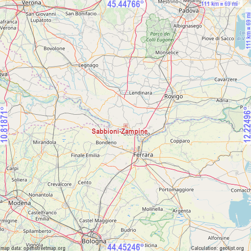
Sabbioni-Zampine GPS coordinates[2]
44° 57' 7.992" North, 11° 31' 18.588" East
| Map corner | latitude | longitude |
|---|---|---|
| Upper-left | 45.44766°, | 10.81871° |
| Center: | 44.95222°, | 11.52183° |
| Lower-right: | 44.45246°, | 12.22496° |
| Map W x H: | 110.7×110.7 km | = 68.8×68.8mi |
| max Lat: | 47.04031° ⇑41.1% North |
| Sabbioni-Zampine: | 44.95222° |
| min Lat: | ⇓58.9% South 35.50142° |
| min Long | Sabbioni-Zampin | max Long |
| 6.69888° | 11.52183° | 18.48682° |
| W 49.7%⇐ | ⇒50.3% E |
Elevation
Elevation of Sabbioni-Zampine is 7 m = 23 ft, and this is 299.7 m = 983 ft below average elevation for this country.
| Max E: |
2085 m = 6841 ft | 95.9% |
| Avg. | 306.7 m = 1006 ft | |
| Sabbioni-Zampine | 7 m = 23 ft | |
Min E: |
-4 m = -13 ft | 4.1% |
See also: Italy elevation on elevation.city.
Geographical zone
Sabbioni-Zampine is located in North temperate zone (between Tropic of Cancer and the Arctic Circle). Distance of this Northern Tropic circle is 2392.3 km =1486.5 mi to South.| Distance of | km | miles | from Sabbioni-Zampine |
|---|---|---|---|
| North Pole | 5008.8 | 3112.3 | to North |
| Arctic Circle | 2403 | 1493.2 | to North |
| Tropic Cancer | 2392.3 | 1486.5 | to South |
| Equator | 4998.2 | 3105.7 | to South |


Nearby cities:
15 places around Sabbioni-Zampine: (largest is in red/bold)
• Bagnolo di Po
7.2 km =4.5 mi,  346°
346°
• Canda
9.4 km =5.8 mi, 351°
• Casaglia
5.8 km =3.6 mi,  164°
164°
• Castelguglielmo
8.2 km =5.1 mi,  8°
8°
• Ficarolo
6.7 km =4.2 mi,  271°
271°
• Fiesso Umbertiano
6.7 km =4.2 mi,  81°
81°
• Gaiba
3.3 km =2.1 mi,  257°
257°
• Occhiobello
5.7 km =3.5 mi,  125°
125°
• Pincara
9.5 km =5.9 mi,  55°
55°
• Salara
8.4 km =5.2 mi,  296°
296°
• San Bellino
10.2 km =6.3 mi,  32°
32°
• Santa Maria Maddalena
8.7 km =5.4 mi, 129°
• Stienta
2.2 km =1.4 mi, 128°
• Trecenta
9.9 km =6.2 mi,  330°
330°
• Vigarano Pieve
10.2 km =6.3 mi,  185°
185°
Sources, notices
• [Note1] Compared only with cities in Italy existing in our database
• [Src1] Map data: © OpenStreetMap contributors (CC-BY-SA)
• [Src2] Other city data from geonames.org with taken over terms of usage.
• [Src3] Geographical zone / Annual Mean Temperature by Robert A. Rohde @ Wikipedia
