Crespellano geodata
Crespellano (Emilia-Romagna) is a seat of a third-order administrative division; located in Italy in Europe/Rome (GMT+1) time zone. With population of 4,438 people, there are 2172 cities with bigger population in this country. Compared to other cities in Italy, 51.2% of cities are located further ↓South; 55.4% of cities are located further →East and 76.8% of cities have higher elevation than Crespellano. Note1


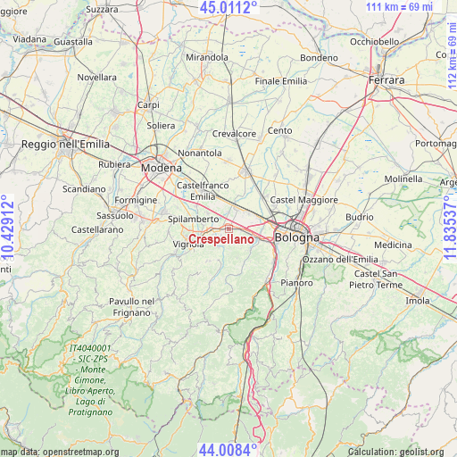
Crespellano GPS coordinates[2]
44° 30' 43.056" North, 11° 7' 56.064" East
| Map corner | latitude | longitude |
|---|---|---|
| Upper-left | 45.0112°, | 10.42912° |
| Center: | 44.51196°, | 11.13224° |
| Lower-right: | 44.0084°, | 11.83537° |
| Map W x H: | 111.5×111.5 km | = 69.3×69.3mi |
| max Lat: | 47.04031° ⇑48.8% North |
| Crespellano: | 44.51196° |
| min Lat: | ⇓51.2% South 35.50142° |
| min Long | Crespellano | max Long |
| 6.69888° | 11.13224° | 18.48682° |
| W 44.6%⇐ | ⇒55.4% E |
Elevation
Elevation of Crespellano is 65 m = 213 ft, and this is 241.7 m = 793 ft below average elevation for this country.
| Max E: |
2085 m = 6841 ft | 76.8% |
| Avg. | 306.7 m = 1006 ft | |
| Crespellano | 65 m = 213 ft | |
Min E: |
-4 m = -13 ft | 23.2% |
See also: Italy elevation on elevation.city.
Geographical zone
Crespellano is located in North temperate zone (between Tropic of Cancer and the Arctic Circle). Distance of this Northern Tropic circle is 2343.3 km =1456.1 mi to South.| Distance of | km | miles | from Crespellano |
|---|---|---|---|
| North Pole | 5057.8 | 3142.8 | to North |
| Arctic Circle | 2451.9 | 1523.5 | to North |
| Tropic Cancer | 2343.3 | 1456.1 | to South |
| Equator | 4949.3 | 3075.4 | to South |


Nearby cities:
15 places around Crespellano: (largest is in red/bold)
• Anzola dell'Emilia
6.7 km =4.2 mi,  60°
60°
• Bazzano
3.8 km =2.4 mi,  252°
252°
• Budrie
9.6 km =6 mi,  24°
24°
• Calcara
3.9 km =2.4 mi,  1°
1°
• Calderino
8 km =5 mi,  138°
138°
• Castelletto
9.6 km =6 mi,  213°
213°
• Cavazzona
6.9 km =4.3 mi,  351°
351°
• Mulino
7.1 km =4.4 mi, 252°
• Piumazzo
6.4 km =4 mi,  306°
306°
• Ponte Ronca
4.7 km =2.9 mi,  104°
104°
• Riale
8.6 km =5.3 mi,  111°
111°
• Savignano sul Panaro
8.5 km =5.3 mi, 245°
• Spilamberto
9.4 km =5.8 mi,  284°
284°
• Stiore
4.4 km =2.7 mi,  195°
195°
• Zola Predosa
7.3 km =4.5 mi, 109°
Sources, notices
• [Note1] Compared only with cities in Italy existing in our database
• [Src1] Map data: © OpenStreetMap contributors (CC-BY-SA)
• [Src2] Other city data from geonames.org with taken over terms of usage.
• [Src3] Geographical zone / Annual Mean Temperature by Robert A. Rohde @ Wikipedia
