Oscano geodata
Oscano (Umbria) is a populated place; located in Italy in Europe/Rome (GMT+2) time zone. With population of 1,293 people, there are 5658 cities with bigger population in this country. Compared to other cities in Italy, 62.1% of cities are located further ↑North; 60.5% of cities are located further ←West and 59.1% of cities have lower elevation than Oscano. Note1


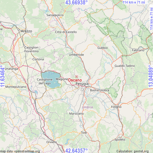
Oscano GPS coordinates[2]
43° 9' 31.068" North, 12° 20' 15.936" East
| Map corner | latitude | longitude |
|---|---|---|
| Upper-left | 43.66938°, | 11.63464° |
| Center: | 43.15863°, | 12.33776° |
| Lower-right: | 42.64357°, | 13.04089° |
| Map W x H: | 114.1×114.1 km | = 70.9×70.9mi |
| max Lat: | 47.04031° ⇑62.1% North |
| Oscano: | 43.15863° |
| min Lat: | ⇓37.9% South 35.50142° |
| min Long | Oscano | max Long |
| 6.69888° | 12.33776° | 18.48682° |
| W 60.5%⇐ | ⇒39.5% E |
Elevation
Elevation of Oscano is 293 m = 961 ft, and this is 13.7 m = 45 ft below average elevation for this country.
| Max E: |
2085 m = 6841 ft | 40.9% |
| Avg. | 306.7 m = 1006 ft | |
| Oscano | 293 m = 961 ft | |
Min E: |
-4 m = -13 ft | 59.1% |
See also: Italy elevation on elevation.city.
Geographical zone
Oscano is located in North temperate zone (between Tropic of Cancer and the Arctic Circle). Distance of this Northern Tropic circle is 2192.9 km =1362.6 mi to South.| Distance of | km | miles | from Oscano |
|---|---|---|---|
| North Pole | 5208.3 | 3236.3 | to North |
| Arctic Circle | 2602.4 | 1617.1 | to North |
| Tropic Cancer | 2192.9 | 1362.6 | to South |
| Equator | 4798.8 | 2981.8 | to South |


Nearby cities:
15 places around Oscano: (largest is in red/bold)
• Casa del Diavolo
9.6 km =6 mi,  70°
70°
• Chiugiana-La Commenda
7.1 km =4.4 mi,  199°
199°
• Comparati
1.1 km =0.7 mi,  275°
275°
• Corciano
5.3 km =3.3 mi,  230°
230°
• Il Rigo
6.8 km =4.2 mi,  206°
206°
• Lacugnano
7.1 km =4.4 mi,  184°
184°
• Mantignana
4 km =2.5 mi,  272°
272°
• Oliveto
4.6 km =2.9 mi,  147°
147°
• Perugia
6.6 km =4.1 mi,  141°
141°
• Ponte Pattoli
7.7 km =4.8 mi, 73°
• Resina I
8.7 km =5.4 mi,  55°
55°
• San Pietro
6.5 km =4 mi, 227°
• Soccorso
8.4 km =5.2 mi,  255°
255°
• Stazione di Parlesca e Solfagnano
9.1 km =5.7 mi,  42°
42°
• bishopric of Perugia
6.6 km =4.1 mi, 140°
Sources, notices
• [Note1] Compared only with cities in Italy existing in our database
• [Src1] Map data: © OpenStreetMap contributors (CC-BY-SA)
• [Src2] Other city data from geonames.org with taken over terms of usage.
• [Src3] Geographical zone / Annual Mean Temperature by Robert A. Rohde @ Wikipedia
