Chiugiana-La Commenda geodata
Chiugiana-La Commenda (Umbria) is a populated place; located in Italy in Europe/Rome (GMT+2) time zone. With population of 10,604 people, there are 893 cities with bigger population in this country. Compared to other cities in Italy, 62.6% of cities are located further ↑North; 60% of cities are located further ←West and 52.1% of cities have lower elevation than Chiugiana-La Commenda. Note1
Current local time in Chiugiana-La Commenda:
05:30 PM, WednesdayDifference from your time zone: hours


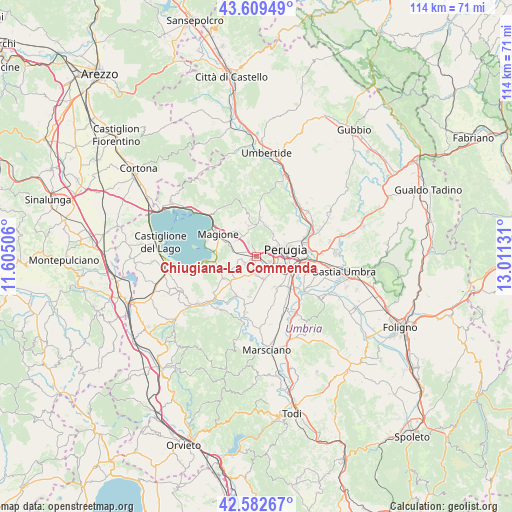
Chiugiana-La Commenda GPS coordinates[2]
43° 5' 53.628" North, 12° 18' 29.448" East
| Map corner | latitude | longitude |
|---|---|---|
| Upper-left | 43.60949°, | 11.60506° |
| Center: | 43.09823°, | 12.30818° |
| Lower-right: | 42.58267°, | 13.01131° |
| Map W x H: | 114.2×114.2 km | = 71×71mi |
| max Lat: | 47.04031° ⇑62.6% North |
| Chiugiana-La Commenda: | 43.09823° |
| min Lat: | ⇓37.4% South 35.50142° |
| min Long | Chiugiana-La Co | max Long |
| 6.69888° | 12.30818° | 18.48682° |
| W 60%⇐ | ⇒40% E |
Elevation
Elevation of Chiugiana-La Commenda is 247 m = 810 ft, and this is 59.7 m = 196 ft below average elevation for this country.
| Max E: |
2085 m = 6841 ft | 47.9% |
| Avg. | 306.7 m = 1006 ft | |
| Chiugiana-La Commenda | 247 m = 810 ft | |
Min E: |
-4 m = -13 ft | 52.1% |
See also: Italy elevation on elevation.city.
Geographical zone
Chiugiana-La Commenda is located in North temperate zone (between Tropic of Cancer and the Arctic Circle). Distance of this Northern Tropic circle is 2186.2 km =1358.4 mi to South.| Distance of | km | miles | from Chiugiana-La Commenda |
|---|---|---|---|
| North Pole | 5215 | 3240.4 | to North |
| Arctic Circle | 2609.1 | 1621.2 | to North |
| Tropic Cancer | 2186.2 | 1358.4 | to South |
| Equator | 4792.1 | 2977.7 | to South |


Nearby cities:
15 places around Chiugiana-La Commenda: (largest is in red/bold)
• Agello
6.4 km =4 mi,  241°
241°
• Comparati
7 km =4.3 mi,  11°
11°
• Corciano
3.8 km =2.4 mi,  332°
332°
• Il Rigo
0.9 km =0.6 mi,  312°
312°
• Lacugnano
1.9 km =1.2 mi,  101°
101°
• Mantignana
7 km =4.3 mi,  346°
346°
• Mugnano
8.6 km =5.3 mi, 236°
• Oliveto
5.7 km =3.5 mi,  60°
60°
• Oscano
7.1 km =4.4 mi,  19°
19°
• Perugia
6.7 km =4.2 mi,  76°
76°
• Pila
5.3 km =3.3 mi,  161°
161°
• San Biagio della Valle
8.8 km =5.5 mi,  190°
190°
• San Pietro
3.3 km =2.1 mi, 313°
• Soccorso
7.3 km =4.5 mi, 308°
• bishopric of Perugia
6.8 km =4.2 mi, 76°
Sources, notices
• [Note1] Compared only with cities in Italy existing in our database
• [Src1] Map data: © OpenStreetMap contributors (CC-BY-SA)
• [Src2] Other city data from geonames.org with taken over terms of usage.
• [Src3] Geographical zone / Annual Mean Temperature by Robert A. Rohde @ Wikipedia
