Tanca Marchese geodata
Tanca Marchese (Sardinia) is a populated place; located in Italy in Europe/Rome (GMT+2) time zone. With population of 641 people, there are 8699 cities with bigger population in this country. Compared to other cities in Italy, 89.3% of cities are located further ↑North; 86.6% of cities are located further →East and 96.6% of cities have higher elevation than Tanca Marchese. Note1


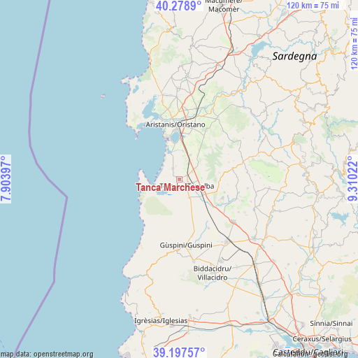
Tanca Marchese GPS coordinates[2]
39° 44' 25.296" North, 8° 36' 25.524" East
| Map corner | latitude | longitude |
|---|---|---|
| Upper-left | 40.2789°, | 7.90397° |
| Center: | 39.74036°, | 8.60709° |
| Lower-right: | 39.19757°, | 9.31022° |
| Map W x H: | 120.2×120.2 km | = 74.7×74.7mi |
| max Lat: | 47.04031° ⇑89.3% North |
| Tanca Marchese: | 39.74036° |
| min Lat: | ⇓10.7% South 35.50142° |
| min Long | Tanca Marchese | max Long |
| 6.69888° | 8.60709° | 18.48682° |
| W 13.4%⇐ | ⇒86.6% E |
Elevation
Elevation of Tanca Marchese is 6 m = 20 ft, and this is 300.7 m = 987 ft below average elevation for this country.
| Max E: |
2085 m = 6841 ft | 96.6% |
| Avg. | 306.7 m = 1006 ft | |
| Tanca Marchese | 6 m = 20 ft | |
Min E: |
-4 m = -13 ft | 3.4% |
See also: Italy elevation on elevation.city.
Geographical zone
Tanca Marchese is located in North temperate zone (between Tropic of Cancer and the Arctic Circle). Distance of this Northern Tropic circle is 1812.8 km =1126.4 mi to South.| Distance of | km | miles | from Tanca Marchese |
|---|---|---|---|
| North Pole | 5588.3 | 3472.4 | to North |
| Arctic Circle | 2982.5 | 1853.2 | to North |
| Tropic Cancer | 1812.8 | 1126.4 | to South |
| Equator | 4418.7 | 2745.7 | to South |


Nearby cities:
15 places around Tanca Marchese: (largest is in red/bold)
• Ales
18.1 km =11.2 mi,  80°
80°
• Arborea
4.2 km =2.6 mi,  328°
328°
• Marrubiu
2.9 km =1.8 mi,  65°
65°
• Masullas
15.7 km =9.8 mi,  106°
106°
• Mogoro
15.8 km =9.8 mi, 113°
• Morgongiori
14 km =8.7 mi,  87°
87°
• Oristano
18.2 km =11.3 mi,  356°
356°
• Palmas Arborea
15.5 km =9.6 mi,  11°
11°
• Pau
17.6 km =10.9 mi, 71°
• Pompu
16.3 km =10.1 mi,  95°
95°
• San Nicolò d'Arcidano
7 km =4.3 mi,  153°
153°
• Santa Giusta
15.6 km =9.7 mi,  0°
0°
• Siris
14.7 km =9.1 mi, 102°
• Terralba
3.2 km =2 mi,  132°
132°
• Uras
9.3 km =5.8 mi,  120°
120°
Sources, notices
• [Note1] Compared only with cities in Italy existing in our database
• [Src1] Map data: © OpenStreetMap contributors (CC-BY-SA)
• [Src2] Other city data from geonames.org with taken over terms of usage.
• [Src3] Geographical zone / Annual Mean Temperature by Robert A. Rohde @ Wikipedia
