San Nicolò d'Arcidano geodata
San Nicolò d'Arcidano (Sardinia) is a seat of a third-order administrative division; located in Italy in Europe/Rome (GMT+2) time zone. With population of 2,580 people, there are 3431 cities with bigger population in this country. Compared to other cities in Italy, 89.6% of cities are located further ↑North; 86.2% of cities are located further →East and 92.6% of cities have higher elevation than San Nicolò d'Arcidano. Note1
Administrative division(s):
- Level 1: Sardinia
- Level 2: Provincia di Oristano
- Level 3: San Nicolò d'Arcidano
Current local time in San Nicolò d'Arcidano:
06:34 PM, WednesdayDifference from your time zone: hours


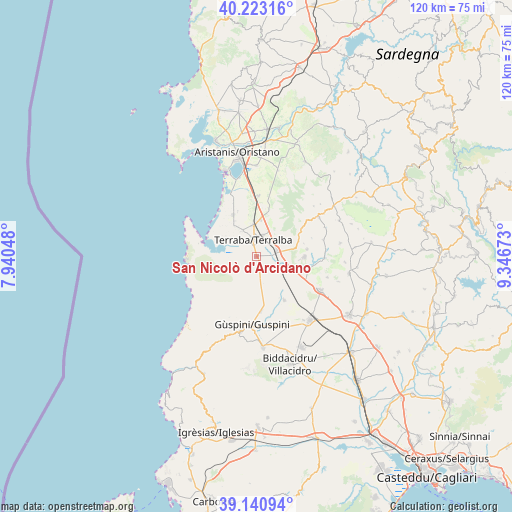
San Nicolò d'Arcidano GPS coordinates[2]
39° 41' 3.012" North, 8° 38' 36.996" East
| Map corner | latitude | longitude |
|---|---|---|
| Upper-left | 40.22316°, | 7.94048° |
| Center: | 39.68417°, | 8.64361° |
| Lower-right: | 39.14094°, | 9.34673° |
| Map W x H: | 120.3×120.3 km | = 74.8×74.8mi |
| max Lat: | 47.04031° ⇑89.6% North |
| San Nicolò d'Arcidano: | 39.68417° |
| min Lat: | ⇓10.4% South 35.50142° |
| min Long | San Nicolò d'A | max Long |
| 6.69888° | 8.64361° | 18.48682° |
| W 13.8%⇐ | ⇒86.2% E |
Elevation
Elevation of San Nicolò d'Arcidano is 13 m = 43 ft, and this is 293.7 m = 964 ft below average elevation for this country.
| Max E: |
2085 m = 6841 ft | 92.6% |
| Avg. | 306.7 m = 1006 ft | |
| San Nicolò d'Arcidano | 13 m = 43 ft | |
Min E: |
-4 m = -13 ft | 7.4% |
See also: Italy elevation on elevation.city.
Geographical zone
San Nicolò d'Arcidano is located in North temperate zone (between Tropic of Cancer and the Arctic Circle). Distance of this Northern Tropic circle is 1806.5 km =1122.5 mi to South.| Distance of | km | miles | from San Nicolò d'Arcidano |
|---|---|---|---|
| North Pole | 5594.6 | 3476.3 | to North |
| Arctic Circle | 2988.7 | 1857.1 | to North |
| Tropic Cancer | 1806.5 | 1122.5 | to South |
| Equator | 4412.5 | 2741.8 | to South |


Nearby cities:
15 places around San Nicolò d'Arcidano: (largest is in red/bold)
• Arborea
11.2 km =7 mi,  331°
331°
• Gonnoscodina
16.5 km =10.3 mi,  84°
84°
• Gonnostramatza
16.2 km =10.1 mi,  90°
90°
• Guspini
16.1 km =10 mi,  182°
182°
• Marrubiu
7.5 km =4.7 mi,  356°
356°
• Masullas
12.1 km =7.5 mi, 81°
• Mogoro
11.4 km =7.1 mi, 90°
• Morgongiori
12.9 km =8 mi,  57°
57°
• Pabillonis
12.2 km =7.6 mi,  146°
146°
• Pompu
13.8 km =8.6 mi,  70°
70°
• Simala
16.3 km =10.1 mi, 75°
• Siris
11.7 km =7.3 mi, 74°
• Tanca Marchese
7 km =4.3 mi, 333°
• Terralba
4.1 km =2.5 mi,  349°
349°
• Uras
5.2 km =3.2 mi, 72°
Sources, notices
• [Note1] Compared only with cities in Italy existing in our database
• [Src1] Map data: © OpenStreetMap contributors (CC-BY-SA)
• [Src2] Other city data from geonames.org with taken over terms of usage.
• [Src3] Geographical zone / Annual Mean Temperature by Robert A. Rohde @ Wikipedia
