Beverare geodata
Beverare (Veneto) is a populated place; located in Italy in Europe/Rome (GMT+2) time zone. With population of 513 people, there are 9792 cities with bigger population in this country. Compared to other cities in Italy, 63.3% of cities are located further ↓South; 55.1% of cities are located further ←West and 97.2% of cities have higher elevation than Beverare. Note1
Administrative division(s):
- Level 1: Veneto
- Level 2: Provincia di Rovigo
- Level 3: San Martino di Venezze


Beverare GPS coordinates[2]
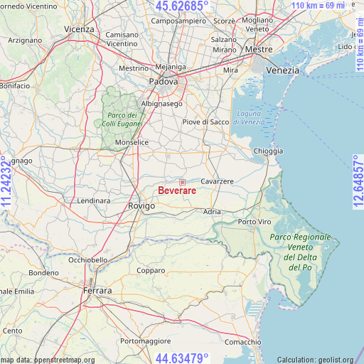
45° 7' 58.728" North, 11° 56' 43.584" East
| Map corner | latitude | longitude |
|---|---|---|
| Upper-left | 45.62685°, | 11.24232° |
| Center: | 45.13298°, | 11.94544° |
| Lower-right: | 44.63479°, | 12.64857° |
| Map W x H: | 110.3×110.3 km | = 68.5×68.5mi |
| max Lat: | 47.04031° ⇑36.7% North |
| Beverare: | 45.13298° |
| min Lat: | ⇓63.3% South 35.50142° |
| min Long | Beverare | max Long |
| 6.69888° | 11.94544° | 18.48682° |
| W 55.1%⇐ | ⇒44.9% E |
Elevation
Elevation of Beverare is 5 m = 16 ft, and this is 301.7 m = 990 ft below average elevation for this country.
| Max E: |
2085 m = 6841 ft | 97.2% |
| Avg. | 306.7 m = 1006 ft | |
| Beverare | 5 m = 16 ft | |
Min E: |
-4 m = -13 ft | 2.8% |
See also: Italy elevation on elevation.city.
Geographical zone
Beverare is located in North temperate zone (between Tropic of Cancer and the Arctic Circle). Distance of this North polar circle is 2382.9 km =1480.7 mi to North.| Distance of | km | miles | from Beverare |
|---|---|---|---|
| North Pole | 4988.7 | 3099.8 | to North |
| Arctic Circle | 2382.9 | 1480.7 | to North |
| Tropic Cancer | 2412.4 | 1499 | to South |
| Equator | 5018.3 | 3118.2 | to South |


Nearby cities:
15 places around Beverare: (largest is in red/bold)
• Agna
4.3 km =2.7 mi,  11°
11°
• Anguillara Veneta
4.9 km =3 mi,  282°
282°
• Arre
9.5 km =5.9 mi,  351°
351°
• Bagnoli di Sopra
7.7 km =4.8 mi,  321°
321°
• Baricetta
9.3 km =5.8 mi,  153°
153°
• Buso
10.8 km =6.7 mi,  225°
225°
• Candiana
10.5 km =6.5 mi,  20°
20°
• Lama Pezzoli
10.3 km =6.4 mi,  195°
195°
• Mardimago
9 km =5.6 mi,  251°
251°
• Pegolotte
9.8 km =6.1 mi,  47°
47°
• Pettorazza Grimani
3.3 km =2.1 mi,  84°
84°
• Rottanova
5.9 km =3.7 mi, 78°
• San Martino di Venezze
6 km =3.7 mi,  261°
261°
• Valliera
9.7 km =6 mi, 145°
• Villadose
7.7 km =4.8 mi,  208°
208°
Sources, notices
• [Note1] Compared only with cities in Italy existing in our database
• [Src1] Map data: © OpenStreetMap contributors (CC-BY-SA)
• [Src2] Other city data from geonames.org with taken over terms of usage.
• [Src3] Geographical zone / Annual Mean Temperature by Robert A. Rohde @ Wikipedia
