Şakhrah geodata
Şakhrah (Ajlun) is a seat of a third-order administrative division; located in Jordan in Asia/Amman (GMT+3) time zone. With population of 10,616 people, there are 35 cities with bigger population in this country. Compared to other cities in Jordan, 71% of cities are located further ↓South; 59.4% of cities are located further ←West and 92% of cities have lower elevation than Şakhrah. Note1


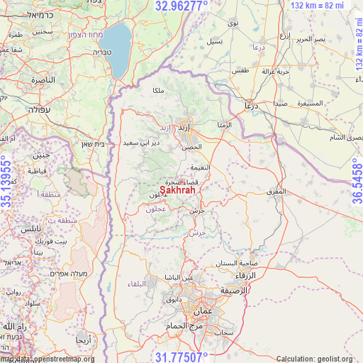
Şakhrah GPS coordinates[2]
32° 22' 15.132" North, 35° 50' 33.612" East
| Map corner | latitude | longitude |
|---|---|---|
| Upper-left | 32.96277°, | 35.13955° |
| Center: | 32.37087°, | 35.84267° |
| Lower-right: | 31.77507°, | 36.5458° |
| Map W x H: | 132.1×132.1 km | = 82.1×82.1mi |
| max Lat: | 33.31405° ⇑29% North |
| Şakhrah: | 32.37087° |
| min Lat: | ⇓71% South 29.40842° |
| min Long | Şakhrah | max Long |
| 34.97918° | 35.84267° | 38.70342° |
| W 59.4%⇐ | ⇒40.6% E |
Elevation
Elevation of Şakhrah is 1083 m = 3553 ft, and this is 397.3 m = 1303 ft above average elevation for this country.
| Max E: |
1440 m = 4724 ft | 8% |
| Şakhrah | 1083 m 3553 ft | |
| Avg. | 685.7 m = 2250 ft | |
Min E: |
-366 m = -1201 ft | 92% |
See also: Jordan elevation on elevation.city.
Geographical zone
Şakhrah is located in North temperate zone (between Tropic of Cancer and the Arctic Circle). Distance of this Northern Tropic circle is 993.4 km =617.3 mi to South.| Distance of | km | miles | from Şakhrah |
|---|---|---|---|
| North Pole | 6407.8 | 3981.6 | to North |
| Arctic Circle | 3801.9 | 2362.4 | to North |
| Tropic Cancer | 993.4 | 617.3 | to South |
| Equator | 3599.3 | 2236.5 | to South |


Nearby cities:
15 places around Şakhrah: (largest is in red/bold)
• Al Kittah
10.5 km =6.5 mi,  180°
180°
• Al Mazār ash Shamālī
11.9 km =7.4 mi,  338°
338°
• Al Ḩişn
13.2 km =8.2 mi,  17°
17°
• Balīlā
9.3 km =5.8 mi,  75°
75°
• Jarash
11.3 km =7 mi,  152°
152°
• Judita
13.3 km =8.3 mi,  288°
288°
• Kitim
9.1 km =5.7 mi,  34°
34°
• Qafqafā
9.4 km =5.8 mi,  105°
105°
• Raymūn
10 km =6.2 mi,  188°
188°
• Sakib
10.1 km =6.3 mi,  198°
198°
• Sūf
6.4 km =4 mi, 184°
• ‘Ajlūn
9.4 km =5.8 mi,  243°
243°
• ‘Anjarah
10.8 km =6.7 mi,  228°
228°
• ‘Ayn Jannah
8.4 km =5.2 mi, 241°
• ‘Irjān
10.6 km =6.6 mi,  284°
284°
Sources, notices
• [Note1] Compared only with cities in Jordan existing in our database
• [Src1] Map data: © OpenStreetMap contributors (CC-BY-SA)
• [Src2] Other city data from geonames.org with taken over terms of usage.
• [Src3] Geographical zone / Annual Mean Temperature by Robert A. Rohde @ Wikipedia
