Sakib geodata
Sakib (Jerash) is a populated place; located in Jordan in Asia/Amman (GMT+3) time zone. With population of 11,586 people, there are 32 cities with bigger population in this country. Compared to other cities in Jordan, 60.9% of cities are located further ↓South; 52.9% of cities are located further ←West and 70.3% of cities have lower elevation than Sakib. Note1


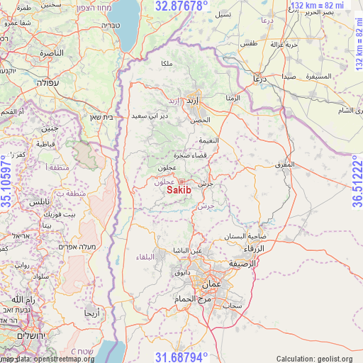
Sakib GPS coordinates[2]
32° 17' 3.516" North, 35° 48' 32.724" East
| Map corner | latitude | longitude |
|---|---|---|
| Upper-left | 32.87678°, | 35.10597° |
| Center: | 32.28431°, | 35.80909° |
| Lower-right: | 31.68794°, | 36.51222° |
| Map W x H: | 132.2×132.2 km | = 82.1×82.1mi |
| max Lat: | 33.31405° ⇑39.1% North |
| Sakib: | 32.28431° |
| min Lat: | ⇓60.9% South 29.40842° |
| min Long | Sakib | max Long |
| 34.97918° | 35.80909° | 38.70342° |
| W 52.9%⇐ | ⇒47.1% E |
Elevation
Elevation of Sakib is 862 m = 2828 ft, and this is 176.3 m = 578 ft above average elevation for this country.
| Max E: |
1440 m = 4724 ft | 29.7% |
| Sakib | 862 m 2828 ft | |
| Avg. | 685.7 m = 2250 ft | |
Min E: |
-366 m = -1201 ft | 70.3% |
See also: Jordan elevation on elevation.city.
Geographical zone
Sakib is located in North temperate zone (between Tropic of Cancer and the Arctic Circle). Distance of this Northern Tropic circle is 983.8 km =611.3 mi to South.| Distance of | km | miles | from Sakib |
|---|---|---|---|
| North Pole | 6417.4 | 3987.6 | to North |
| Arctic Circle | 3811.5 | 2368.4 | to North |
| Tropic Cancer | 983.8 | 611.3 | to South |
| Equator | 3589.7 | 2230.5 | to South |


Nearby cities:
15 places around Sakib: (largest is in red/bold)
• Al Kittah
3.1 km =1.9 mi,  105°
105°
• Al Maşţabah
12 km =7.5 mi,  158°
158°
• Balīlā
17 km =10.6 mi,  45°
45°
• Burmā
7.6 km =4.7 mi,  197°
197°
• Jarash
8.5 km =5.3 mi,  92°
92°
• Judita
16.7 km =10.4 mi,  325°
325°
• Kufrinjah
10.2 km =6.3 mi,  278°
278°
• Qafqafā
14.1 km =8.8 mi,  59°
59°
• Raymūn
1.8 km =1.1 mi,  98°
98°
• Sūf
4.2 km =2.6 mi,  38°
38°
• Şakhrah
10.1 km =6.3 mi,  18°
18°
• ‘Ajlūn
7.6 km =4.7 mi,  315°
315°
• ‘Anjarah
5.5 km =3.4 mi,  296°
296°
• ‘Ayn Jannah
7 km =4.3 mi, 322°
• ‘Irjān
14.2 km =8.8 mi, 329°
Sources, notices
• [Note1] Compared only with cities in Jordan existing in our database
• [Src1] Map data: © OpenStreetMap contributors (CC-BY-SA)
• [Src2] Other city data from geonames.org with taken over terms of usage.
• [Src3] Geographical zone / Annual Mean Temperature by Robert A. Rohde @ Wikipedia
