‘Anjarah geodata
‘Anjarah (Ajlun) is a populated place; located in Jordan in Asia/Amman (GMT+3) time zone. With population of 17,634 people, there are 25 cities with bigger population in this country. Compared to other cities in Jordan, 62.3% of cities are located further ↓South; 61.6% of cities are located further →East and 74.6% of cities have lower elevation than ‘Anjarah. Note1


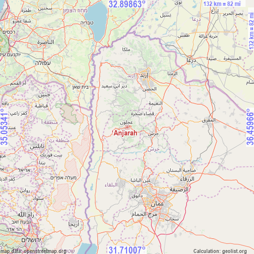
‘Anjarah GPS coordinates[2]
32° 18' 22.68" North, 35° 45' 23.508" East
| Map corner | latitude | longitude |
|---|---|---|
| Upper-left | 32.89863°, | 35.05341° |
| Center: | 32.3063°, | 35.75653° |
| Lower-right: | 31.71007°, | 36.45966° |
| Map W x H: | 132.2×132.2 km | = 82.1×82.1mi |
| max Lat: | 33.31405° ⇑37.7% North |
| ‘Anjarah: | 32.3063° |
| min Lat: | ⇓62.3% South 29.40842° |
| min Long | ‘Anjarah | max Long |
| 34.97918° | 35.75653° | 38.70342° |
| W 38.4%⇐ | ⇒61.6% E |
Elevation
Elevation of ‘Anjarah is 890 m = 2920 ft, and this is 204.3 m = 670 ft above average elevation for this country.
| Max E: |
1440 m = 4724 ft | 25.4% |
| ‘Anjarah | 890 m 2920 ft | |
| Avg. | 685.7 m = 2250 ft | |
Min E: |
-366 m = -1201 ft | 74.6% |
See also: Jordan elevation on elevation.city.
Geographical zone
‘Anjarah is located in North temperate zone (between Tropic of Cancer and the Arctic Circle). Distance of this Northern Tropic circle is 986.2 km =612.8 mi to South.| Distance of | km | miles | from ‘Anjarah |
|---|---|---|---|
| North Pole | 6414.9 | 3986 | to North |
| Arctic Circle | 3809.1 | 2366.9 | to North |
| Tropic Cancer | 986.2 | 612.8 | to South |
| Equator | 3592.1 | 2232 | to South |


Nearby cities:
15 places around ‘Anjarah: (largest is in red/bold)
• Al Kittah
8.6 km =5.3 mi,  112°
112°
• Burmā
10 km =6.2 mi,  164°
164°
• Jarash
13.7 km =8.5 mi,  101°
101°
• Judita
12.2 km =7.6 mi,  338°
338°
• Kafr Abīl
15.2 km =9.4 mi,  324°
324°
• Kufrinjah
5.2 km =3.2 mi,  259°
259°
• Kurayyimah
15.1 km =9.4 mi, 257°
• Raymūn
7.2 km =4.5 mi, 111°
• Sakib
5.5 km =3.4 mi,  116°
116°
• Sūf
7.6 km =4.7 mi,  83°
83°
• Şakhrah
10.8 km =6.7 mi,  48°
48°
• Ḩalāwah
12.4 km =7.7 mi,  314°
314°
• ‘Ajlūn
3 km =1.9 mi,  353°
353°
• ‘Ayn Jannah
3.2 km =2 mi,  12°
12°
• ‘Irjān
10 km =6.2 mi, 347°
Sources, notices
• [Note1] Compared only with cities in Jordan existing in our database
• [Src1] Map data: © OpenStreetMap contributors (CC-BY-SA)
• [Src2] Other city data from geonames.org with taken over terms of usage.
• [Src3] Geographical zone / Annual Mean Temperature by Robert A. Rohde @ Wikipedia
