Al Karāmah geodata
Al Karāmah (Balqa) is a populated place; located in Jordan in Asia/Amman (GMT+3) time zone. With population of 9,384 people, there are 38 cities with bigger population in this country. Compared to other cities in Jordan, 60.1% of cities are located further ↑North; 91.3% of cities are located further →East and 98.6% of cities have higher elevation than Al Karāmah. Note1


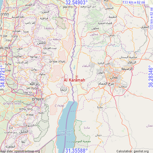
Al Karāmah GPS coordinates[2]
31° 57' 15.804" North, 35° 34' 49.188" East
| Map corner | latitude | longitude |
|---|---|---|
| Upper-left | 32.54903°, | 34.87721° |
| Center: | 31.95439°, | 35.58033° |
| Lower-right: | 31.35588°, | 36.28346° |
| Map W x H: | 132.7×132.7 km | = 82.5×82.5mi |
| max Lat: | 33.31405° ⇑60.1% North |
| Al Karāmah: | 31.95439° |
| min Lat: | ⇓39.9% South 29.40842° |
| min Long | Al Karāmah | max Long |
| 34.97918° | 35.58033° | 38.70342° |
| W 8.7%⇐ | ⇒91.3% E |
Elevation
Elevation of Al Karāmah is -255 m = -837 ft, and this is 940.7 m = 3086 ft below average elevation for this country.
| Max E: |
1440 m = 4724 ft | 98.6% |
| Avg. | 685.7 m = 2250 ft | |
| Al Karāmah | -255 m = -837 ft | |
Min E: |
-366 m = -1201 ft | 1.4% |
See also: Jordan elevation on elevation.city.
Geographical zone
Al Karāmah is located in North temperate zone (between Tropic of Cancer and the Arctic Circle). Distance of this Northern Tropic circle is 947.1 km =588.5 mi to South.| Distance of | km | miles | from Al Karāmah |
|---|---|---|---|
| North Pole | 6454.1 | 4010.4 | to North |
| Arctic Circle | 3848.2 | 2391.2 | to North |
| Tropic Cancer | 947.1 | 588.5 | to South |
| Equator | 3553 | 2207.7 | to South |


Nearby cities:
15 places around Al Karāmah: (largest is in red/bold)
• Al Fayşalīyah
29 km =18 mi,  141°
141°
• Al Fuḩayş
19.7 km =12.2 mi,  73°
73°
• As Salţ
16.8 km =10.4 mi,  55°
55°
• Ash Shūnah al Janūbīyah
7.8 km =4.8 mi,  153°
153°
• Aş Şubayḩī
24.6 km =15.3 mi,  28°
28°
• Dayr ‘Allā
27.1 km =16.8 mi,  8°
8°
• Juraynah
29.6 km =18.4 mi, 136°
• Nā‘ūr
24.7 km =15.3 mi,  111°
111°
• Umm as Summāq
27 km =16.8 mi, 106°
• Wādī as Sīr
22.5 km =14 mi,  89°
89°
• Yarqā
11.2 km =7 mi,  77°
77°
• Ḩayy al Bunayyāt
29.4 km =18.3 mi,  102°
102°
• Ḩisbān
27.8 km =17.3 mi,  128°
128°
• ‘Allān
23.8 km =14.8 mi,  40°
40°
• ‘Ayn al Bāshā
26.3 km =16.3 mi, 64°
Sources, notices
• [Note1] Compared only with cities in Jordan existing in our database
• [Src1] Map data: © OpenStreetMap contributors (CC-BY-SA)
• [Src2] Other city data from geonames.org with taken over terms of usage.
• [Src3] Geographical zone / Annual Mean Temperature by Robert A. Rohde @ Wikipedia
