Kamiichi geodata
Kamiichi (Toyama) is a populated place; located in Japan in Asia/Tokyo (GMT+9) time zone. With population of 23,004 people, there are 641 cities with bigger population in this country. Compared to other cities in Japan, 79.7% of cities are located further ↓South; 51.1% of cities are located further ←West and 58.2% of cities have lower elevation than Kamiichi. Note1


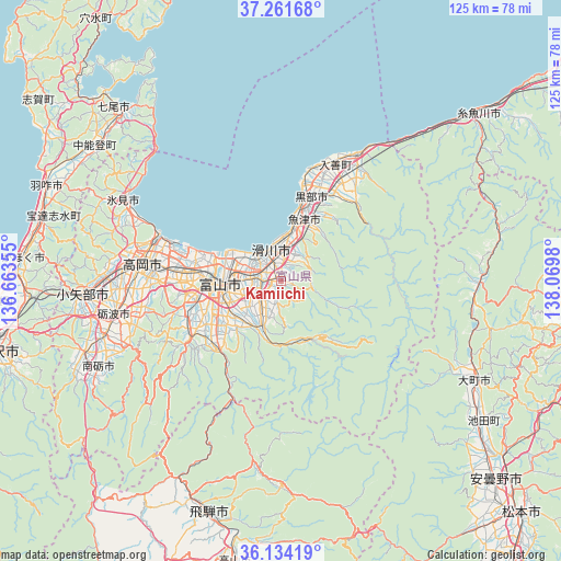
Kamiichi GPS coordinates[2]
36° 42' 0" North, 137° 22' 0.012" East
| Map corner | latitude | longitude |
|---|---|---|
| Upper-left | 37.26168°, | 136.66355° |
| Center: | 36.7°, | 137.36667° |
| Lower-right: | 36.13419°, | 138.0698° |
| Map W x H: | 125.4×125.4 km | = 77.9×77.9mi |
| max Lat: | 45.40944° ⇑20.3% North |
| Kamiichi: | 36.7° |
| min Lat: | ⇓79.7% South 24.34478° |
| min Long | Kamiichi | max Long |
| 123° | 137.36667° | 145.575° |
| W 51.1%⇐ | ⇒48.9% E |
Elevation
Elevation of Kamiichi is 42 m = 138 ft, and this is 42.6 m = 140 ft below average elevation for this country.
| Max E: |
1086 m = 3563 ft | 41.8% |
| Avg. | 84.6 m = 278 ft | |
| Kamiichi | 42 m = 138 ft | |
Min E: |
-2 m = -7 ft | 58.2% |
See also: Japan elevation on elevation.city.
Geographical zone
Kamiichi is located in North temperate zone (between Tropic of Cancer and the Arctic Circle). Distance of this Northern Tropic circle is 1474.7 km =916.3 mi to South.| Distance of | km | miles | from Kamiichi |
|---|---|---|---|
| North Pole | 5926.4 | 3682.5 | to North |
| Arctic Circle | 3320.5 | 2063.3 | to North |
| Tropic Cancer | 1474.7 | 916.3 | to South |
| Equator | 4080.7 | 2535.6 | to South |


Nearby cities:
15 places around Kamiichi: (largest is in red/bold)
• Hakuba
44.1 km =27.4 mi,  90°
90°
• Himi
37.8 km =23.5 mi,  295°
295°
• Himimachi
37.9 km =23.5 mi, 297°
• Imizu
22.8 km =14.2 mi,  289°
289°
• Kurobe-shi
23.6 km =14.7 mi,  18°
18°
• Namerikawa
6.6 km =4.1 mi,  356°
356°
• Nanto-shi
43.1 km =26.8 mi,  250°
250°
• Nishishinminato
27.4 km =17 mi, 288°
• Nyūzen
29 km =18 mi, 24°
• Oyabe
46.2 km =28.7 mi,  265°
265°
• Takaoka
31.7 km =19.7 mi,  280°
280°
• Tonami
38.8 km =24.1 mi,  256°
256°
• Toyama
13.4 km =8.3 mi, 270°
• Uozu
11.5 km =7.1 mi,  14°
14°
• Yatsuomachi-higashikumisaka
25.6 km =15.9 mi,  234°
234°
Sources, notices
• [Note1] Compared only with cities in Japan existing in our database
• [Src1] Map data: © OpenStreetMap contributors (CC-BY-SA)
• [Src2] Other city data from geonames.org with taken over terms of usage.
• [Src3] Geographical zone / Annual Mean Temperature by Robert A. Rohde @ Wikipedia
