Namerikawa geodata
Namerikawa (Toyama) is a seat of a second-order administrative division; located in Japan in Asia/Tokyo (GMT+9) time zone. With population of 34,638 people, there are 500 cities with bigger population in this country. Compared to other cities in Japan, 80.6% of cities are located further ↓South; 51% of cities are located further ←West and 55.4% of cities have higher elevation than Namerikawa. Note1


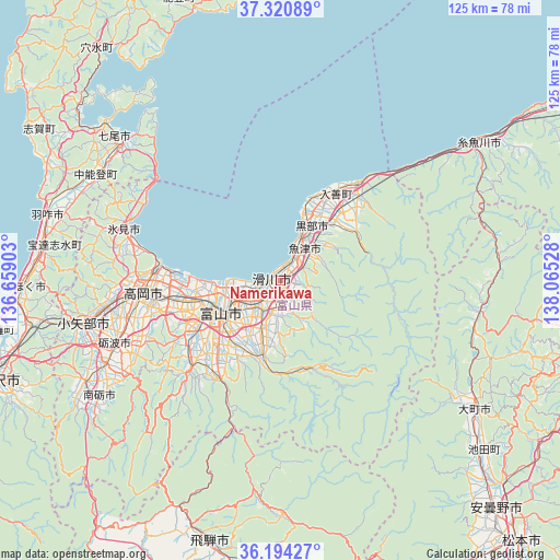
Namerikawa GPS coordinates[2]
36° 45' 34.74" North, 137° 21' 43.74" East
| Map corner | latitude | longitude |
|---|---|---|
| Upper-left | 37.32089°, | 136.65903° |
| Center: | 36.75965°, | 137.36215° |
| Lower-right: | 36.19427°, | 138.06528° |
| Map W x H: | 125.3×125.3 km | = 77.9×77.9mi |
| max Lat: | 45.40944° ⇑19.4% North |
| Namerikawa: | 36.75965° |
| min Lat: | ⇓80.6% South 24.34478° |
| min Long | Namerikawa | max Long |
| 123° | 137.36215° | 145.575° |
| W 51%⇐ | ⇒49% E |
Elevation
Elevation of Namerikawa is 23 m = 75 ft, and this is 61.6 m = 202 ft below average elevation for this country.
| Max E: |
1086 m = 3563 ft | 55.4% |
| Avg. | 84.6 m = 278 ft | |
| Namerikawa | 23 m = 75 ft | |
Min E: |
-2 m = -7 ft | 44.6% |
See also: Japan elevation on elevation.city.
Geographical zone
Namerikawa is located in North temperate zone (between Tropic of Cancer and the Arctic Circle). Distance of this Northern Tropic circle is 1481.4 km =920.5 mi to South.| Distance of | km | miles | from Namerikawa |
|---|---|---|---|
| North Pole | 5919.8 | 3678.4 | to North |
| Arctic Circle | 3313.9 | 2059.2 | to North |
| Tropic Cancer | 1481.4 | 920.5 | to South |
| Equator | 4087.3 | 2539.7 | to South |


Nearby cities:
15 places around Namerikawa: (largest is in red/bold)
• Hakuba
45.1 km =28 mi,  98°
98°
• Himi
35.1 km =21.8 mi,  286°
286°
• Himimachi
34.9 km =21.7 mi, 287°
• Imizu
21.1 km =13.1 mi,  272°
272°
• Kamiichi
6.6 km =4.1 mi,  176°
176°
• Kurobe-shi
17.6 km =10.9 mi,  26°
26°
• Nanto-shi
45.4 km =28.2 mi,  242°
242°
• Nishishinminato
25.6 km =15.9 mi, 274°
• Nyūzen
23.3 km =14.5 mi, 31°
• Oyabe
46.8 km =29.1 mi,  257°
257°
• Takaoka
30.8 km =19.1 mi, 268°
• Tonami
40.4 km =25.1 mi,  247°
247°
• Toyama
14.6 km =9.1 mi, 242°
• Uozu
5.6 km =3.5 mi,  36°
36°
• Yatsuomachi-higashikumisaka
29.6 km =18.4 mi,  223°
223°
Sources, notices
• [Note1] Compared only with cities in Japan existing in our database
• [Src1] Map data: © OpenStreetMap contributors (CC-BY-SA)
• [Src2] Other city data from geonames.org with taken over terms of usage.
• [Src3] Geographical zone / Annual Mean Temperature by Robert A. Rohde @ Wikipedia
