Wajima geodata
Wajima (Ishikawa) is a seat of a second-order administrative division; located in Japan in Asia/Tokyo (GMT+9) time zone. In our database, there are 767 cities with bigger population. Compared to other cities in Japan, 83.6% of cities are located further ↓South; 53.6% of cities are located further →East and 65.3% of cities have higher elevation than Wajima. Note1


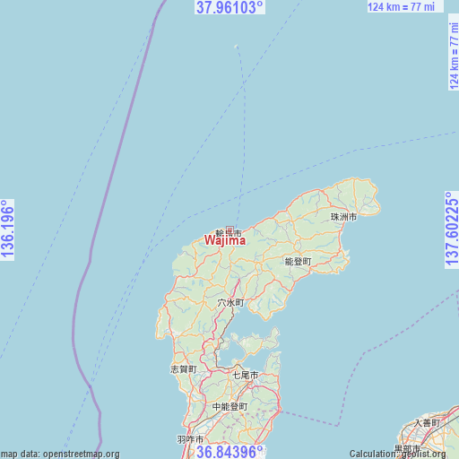
Wajima GPS coordinates[2]
37° 24' 16.488" North, 136° 53' 56.832" East
| Map corner | latitude | longitude |
|---|---|---|
| Upper-left | 37.96103°, | 136.196° |
| Center: | 37.40458°, | 136.89912° |
| Lower-right: | 36.84396°, | 137.60225° |
| Map W x H: | 124.2×124.2 km | = 77.2×77.2mi |
| max Lat: | 45.40944° ⇑16.4% North |
| Wajima: | 37.40458° |
| min Lat: | ⇓83.6% South 24.34478° |
| min Long | Wajima | max Long |
| 123° | 136.89912° | 145.575° |
| W 46.4%⇐ | ⇒53.6% E |
Elevation
Elevation of Wajima is 15 m = 49 ft, and this is 69.6 m = 228 ft below average elevation for this country.
| Max E: |
1086 m = 3563 ft | 65.3% |
| Avg. | 84.6 m = 278 ft | |
| Wajima | 15 m = 49 ft | |
Min E: |
-2 m = -7 ft | 34.7% |
See also: Japan elevation on elevation.city.
Geographical zone
Wajima is located in North temperate zone (between Tropic of Cancer and the Arctic Circle). Distance of this Northern Tropic circle is 1553.1 km =965.1 mi to South.| Distance of | km | miles | from Wajima |
|---|---|---|---|
| North Pole | 5848.1 | 3633.8 | to North |
| Arctic Circle | 3242.2 | 2014.6 | to North |
| Tropic Cancer | 1553.1 | 965.1 | to South |
| Equator | 4159 | 2584.3 | to South |


Nearby cities:
15 places around Wajima: (largest is in red/bold)
• Hakui
58.9 km =36.6 mi,  190°
190°
• Himi
62.5 km =38.8 mi,  173°
173°
• Himimachi
61.5 km =38.2 mi, 172°
• Imizu
73.5 km =45.7 mi,  164°
164°
• Kahoku
73.8 km =45.9 mi, 193°
• Kurobe-shi
74.2 km =46.1 mi,  138°
138°
• Namerikawa
82.6 km =51.3 mi,  150°
150°
• Nanao
39.9 km =24.8 mi, 171°
• Nishishinminato
71.2 km =44.2 mi, 167°
• Nyūzen
74.4 km =46.2 mi,  134°
134°
• Oyabe
82.2 km =51.1 mi,  183°
183°
• Suzu
32.1 km =19.9 mi,  84°
84°
• Takaoka
73.5 km =45.7 mi, 171°
• Tsubata
82.9 km =51.5 mi, 189°
• Uozu
80.6 km =50.1 mi, 146°
Sources, notices
• [Note1] Compared only with cities in Japan existing in our database
• [Src1] Map data: © OpenStreetMap contributors (CC-BY-SA)
• [Src2] Other city data from geonames.org with taken over terms of usage.
• [Src3] Geographical zone / Annual Mean Temperature by Robert A. Rohde @ Wikipedia
