Kurobe-shi geodata
Kurobe-shi (Toyama) is a seat of a second-order administrative division; located in Japan in Asia/Tokyo (GMT+9) time zone. With population of 42,613 people, there are 425 cities with bigger population in this country. Compared to other cities in Japan, 81.7% of cities are located further ↓South; 51.6% of cities are located further ←West and 65.3% of cities have higher elevation than Kurobe-shi. Note1


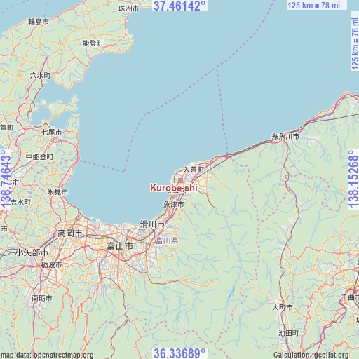
Kurobe-shi GPS coordinates[2]
36° 54' 4.428" North, 137° 26' 58.38" East
| Map corner | latitude | longitude |
|---|---|---|
| Upper-left | 37.46142°, | 136.74643° |
| Center: | 36.90123°, | 137.44955° |
| Lower-right: | 36.33689°, | 138.15268° |
| Map W x H: | 125×125 km | = 77.7×77.7mi |
| max Lat: | 45.40944° ⇑18.3% North |
| Kurobe-shi: | 36.90123° |
| min Lat: | ⇓81.7% South 24.34478° |
| min Long | Kurobe-shi | max Long |
| 123° | 137.44955° | 145.575° |
| W 51.6%⇐ | ⇒48.4% E |
Elevation
Elevation of Kurobe-shi is 15 m = 49 ft, and this is 69.6 m = 228 ft below average elevation for this country.
| Max E: |
1086 m = 3563 ft | 65.3% |
| Avg. | 84.6 m = 278 ft | |
| Kurobe-shi | 15 m = 49 ft | |
Min E: |
-2 m = -7 ft | 34.7% |
See also: Kurobe-shi elevation on elevation.city.
Geographical zone
Kurobe-shi is located in North temperate zone (between Tropic of Cancer and the Arctic Circle). Distance of this Northern Tropic circle is 1497.1 km =930.3 mi to South.| Distance of | km | miles | from Kurobe-shi |
|---|---|---|---|
| North Pole | 5904 | 3668.6 | to North |
| Arctic Circle | 3298.1 | 2049.3 | to North |
| Tropic Cancer | 1497.1 | 930.3 | to South |
| Equator | 4103 | 2549.5 | to South |


Nearby cities:
15 places around Kurobe-shi: (largest is in red/bold)
• Hakuba
43.1 km =26.8 mi,  121°
121°
• Himi
41.9 km =26 mi,  261°
261°
• Himimachi
41.3 km =25.7 mi, 263°
• Imizu
32.4 km =20.1 mi,  242°
242°
• Itoigawa
38.5 km =23.9 mi,  67°
67°
• Kamiichi
23.6 km =14.7 mi,  198°
198°
• Namerikawa
17.6 km =10.9 mi,  206°
206°
• Nanao
46 km =28.6 mi,  291°
291°
• Nishishinminato
35.9 km =22.3 mi,  247°
247°
• Nyūzen
6.1 km =3.8 mi,  48°
48°
• Takaoka
42 km =26.1 mi, 246°
• Tonami
54.9 km =34.1 mi, 235°
• Toyama
30.5 km =19 mi,  222°
222°
• Uozu
12.1 km =7.5 mi, 201°
• Yatsuomachi-higashikumisaka
46.7 km =29 mi, 217°
Sources, notices
• [Note1] Compared only with cities in Japan existing in our database
• [Src1] Map data: © OpenStreetMap contributors (CC-BY-SA)
• [Src2] Other city data from geonames.org with taken over terms of usage.
• [Src3] Geographical zone / Annual Mean Temperature by Robert A. Rohde @ Wikipedia
