Nyūzen geodata
Nyūzen (Toyama) is a populated place; located in Japan in Asia/Tokyo (GMT+9) time zone. With population of 27,585 people, there are 573 cities with bigger population in this country. Compared to other cities in Japan, 81.7% of cities are located further ↓South; 51.8% of cities are located further ←West and 54% of cities have higher elevation than Nyūzen. Note1


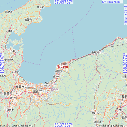
Nyūzen GPS coordinates[2]
36° 56' 14.784" North, 137° 30' 2.124" East
| Map corner | latitude | longitude |
|---|---|---|
| Upper-left | 37.49737°, | 136.79747° |
| Center: | 36.93744°, | 137.50059° |
| Lower-right: | 36.37337°, | 138.20372° |
| Map W x H: | 125×125 km | = 77.7×77.7mi |
| max Lat: | 45.40944° ⇑18.3% North |
| Nyūzen: | 36.93744° |
| min Lat: | ⇓81.7% South 24.34478° |
| min Long | Nyūzen | max Long |
| 123° | 137.50059° | 145.575° |
| W 51.8%⇐ | ⇒48.2% E |
Elevation
Elevation of Nyūzen is 24 m = 79 ft, and this is 60.6 m = 199 ft below average elevation for this country.
| Max E: |
1086 m = 3563 ft | 54% |
| Avg. | 84.6 m = 278 ft | |
| Nyūzen | 24 m = 79 ft | |
Min E: |
-2 m = -7 ft | 46% |
See also: Japan elevation on elevation.city.
Geographical zone
Nyūzen is located in North temperate zone (between Tropic of Cancer and the Arctic Circle). Distance of this Northern Tropic circle is 1501.1 km =932.7 mi to South.| Distance of | km | miles | from Nyūzen |
|---|---|---|---|
| North Pole | 5900 | 3666.1 | to North |
| Arctic Circle | 3294.1 | 2046.9 | to North |
| Tropic Cancer | 1501.1 | 932.7 | to South |
| Equator | 4107.1 | 2552 | to South |


Nearby cities:
15 places around Nyūzen: (largest is in red/bold)
• Hakuba
41.7 km =25.9 mi,  129°
129°
• Himi
47.1 km =29.3 mi,  257°
257°
• Himimachi
46.4 km =28.8 mi, 258°
• Imizu
38.3 km =23.8 mi,  240°
240°
• Itoigawa
32.8 km =20.4 mi,  71°
71°
• Kamiichi
29 km =18 mi,  204°
204°
• Kurobe-shi
6.1 km =3.8 mi,  228°
228°
• Namerikawa
23.3 km =14.5 mi,  211°
211°
• Nanao
49 km =30.4 mi,  284°
284°
• Nishishinminato
41.7 km =25.9 mi,  245°
245°
• Takaoka
47.8 km =29.7 mi, 244°
• Toyama
36.5 km =22.7 mi,  223°
223°
• Uozu
17.7 km =11 mi, 210°
• Yatsuomachi-higashikumisaka
52.6 km =32.7 mi, 218°
• Ōmachi
58.6 km =36.4 mi,  146°
146°
Sources, notices
• [Note1] Compared only with cities in Japan existing in our database
• [Src1] Map data: © OpenStreetMap contributors (CC-BY-SA)
• [Src2] Other city data from geonames.org with taken over terms of usage.
• [Src3] Geographical zone / Annual Mean Temperature by Robert A. Rohde @ Wikipedia
