Ushibukamachi geodata
Ushibukamachi (Kumamoto) is a populated place; located in Japan in Asia/Tokyo (GMT+9) time zone. With population of 16,667 people, there are 729 cities with bigger population in this country. Compared to other cities in Japan, 94.2% of cities are located further ↑North; 96.6% of cities are located further →East and 78.3% of cities have lower elevation than Ushibukamachi. Note1


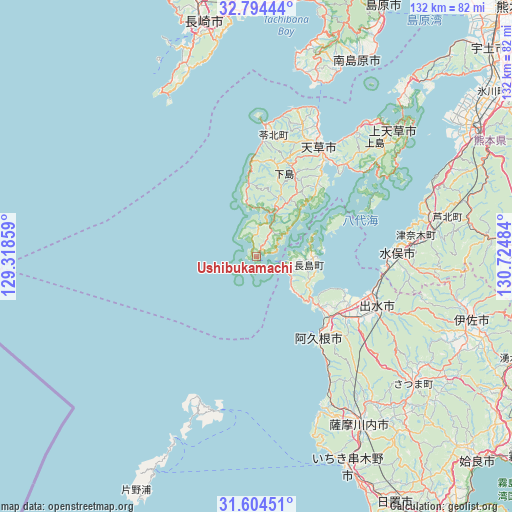
Ushibukamachi GPS coordinates[2]
32° 12' 5.112" North, 130° 1' 18.156" East
| Map corner | latitude | longitude |
|---|---|---|
| Upper-left | 32.79444°, | 129.31859° |
| Center: | 32.20142°, | 130.02171° |
| Lower-right: | 31.60451°, | 130.72484° |
| Map W x H: | 132.3×132.3 km | = 82.2×82.2mi |
| max Lat: | 45.40944° ⇑94.2% North |
| Ushibukamachi: | 32.20142° |
| min Lat: | ⇓5.8% South 24.34478° |
| min Long | Ushibukamachi | max Long |
| 123° | 130.02171° | 145.575° |
| W 3.4%⇐ | ⇒96.6% E |
Elevation
Elevation of Ushibukamachi is 109 m = 358 ft, and this is 24.4 m = 80 ft above average elevation for this country.
| Max E: |
1086 m = 3563 ft | 21.7% |
| Ushibukamachi | 109 m 358 ft | |
| Avg. | 84.6 m = 278 ft | |
Min E: |
-2 m = -7 ft | 78.3% |
See also: Japan elevation on elevation.city.
Geographical zone
Ushibukamachi is located in North temperate zone (between Tropic of Cancer and the Arctic Circle). Distance of this Northern Tropic circle is 974.5 km =605.5 mi to South.| Distance of | km | miles | from Ushibukamachi |
|---|---|---|---|
| North Pole | 6426.6 | 3993.3 | to North |
| Arctic Circle | 3820.7 | 2374.1 | to North |
| Tropic Cancer | 974.5 | 605.5 | to South |
| Equator | 3580.5 | 2224.8 | to South |


Nearby cities:
15 places around Ushibukamachi: (largest is in red/bold)
• Akune
26.5 km =16.5 mi,  140°
140°
• Amakusa
32.8 km =20.4 mi,  29°
29°
• Hondomachi-hondo
31.8 km =19.8 mi, 25°
• Honmachi
63.9 km =39.7 mi,  58°
58°
• Ichikikushikino
58.4 km =36.3 mi,  154°
154°
• Isa
57.5 km =35.7 mi,  105°
105°
• Izumi
35 km =21.7 mi, 112°
• Kamiamakusa
47.4 km =29.5 mi,  47°
47°
• Kushikino
58.6 km =36.4 mi,  156°
156°
• Minamata
35.6 km =22.1 mi,  87°
87°
• Minamishimabara
57.3 km =35.6 mi,  23°
23°
• Nagasaki
62.4 km =38.8 mi,  347°
347°
• Satsumasendai
50.2 km =31.2 mi, 148°
• Unzen
66.8 km =41.5 mi, 18°
• Ōkuchi-shinohara
58.7 km =36.5 mi,  104°
104°
Sources, notices
• [Note1] Compared only with cities in Japan existing in our database
• [Src1] Map data: © OpenStreetMap contributors (CC-BY-SA)
• [Src2] Other city data from geonames.org with taken over terms of usage.
• [Src3] Geographical zone / Annual Mean Temperature by Robert A. Rohde @ Wikipedia
