Tottori geodata
Tottori is a seat of a first-order administrative division; located in Japan in Asia/Tokyo (GMT+9) time zone. With population of 154,098 people, there are 136 cities with bigger population in this country. Compared to other cities in Japan, 53.6% of cities are located further ↓South; 73.9% of cities are located further →East and 86% of cities have higher elevation than Tottori. Note1


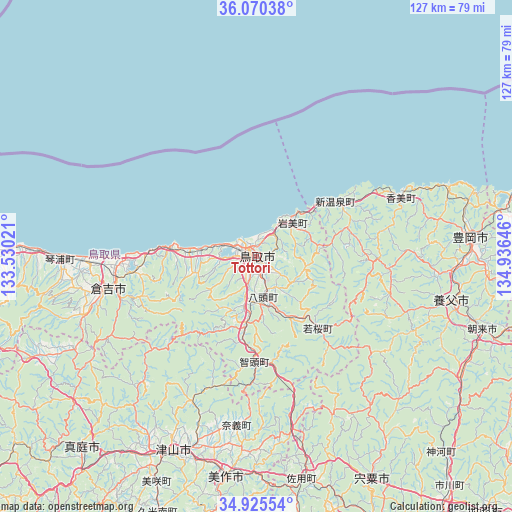
Tottori GPS coordinates[2]
35° 30' 0" North, 134° 13' 59.988" East
| Map corner | latitude | longitude |
|---|---|---|
| Upper-left | 36.07038°, | 133.53021° |
| Center: | 35.5°, | 134.23333° |
| Lower-right: | 34.92554°, | 134.93646° |
| Map W x H: | 127.3×127.3 km | = 79.1×79.1mi |
| max Lat: | 45.40944° ⇑46.4% North |
| Tottori: | 35.5° |
| min Lat: | ⇓53.6% South 24.34478° |
| min Long | Tottori | max Long |
| 123° | 134.23333° | 145.575° |
| W 26.1%⇐ | ⇒73.9% E |
Elevation
Elevation of Tottori is 6 m = 20 ft, and this is 78.6 m = 258 ft below average elevation for this country.
| Max E: |
1086 m = 3563 ft | 86% |
| Avg. | 84.6 m = 278 ft | |
| Tottori | 6 m = 20 ft | |
Min E: |
-2 m = -7 ft | 14% |
See also: Tottori elevation on elevation.city.
Geographical zone
Tottori is located in North temperate zone (between Tropic of Cancer and the Arctic Circle). Distance of this Northern Tropic circle is 1341.3 km =833.4 mi to South.| Distance of | km | miles | from Tottori |
|---|---|---|---|
| North Pole | 6059.8 | 3765.4 | to North |
| Arctic Circle | 3453.9 | 2146.2 | to North |
| Tropic Cancer | 1341.3 | 833.4 | to South |
| Equator | 3947.2 | 2452.7 | to South |


Nearby cities:
15 places around Tottori: (largest is in red/bold)
• Aioi
80.3 km =49.9 mi,  164°
164°
• Akaiwa
79.1 km =49.2 mi,  194°
194°
• Asago
59.1 km =36.7 mi,  116°
116°
• Bizen
79.3 km =49.3 mi,  179°
179°
• Kurayoshi
38.5 km =23.9 mi,  258°
258°
• Kyōtango
74.3 km =46.2 mi,  80°
80°
• Maniwa
63.9 km =39.7 mi,  226°
226°
• Mimasaka
51 km =31.7 mi, 180°
• Shisō
65 km =40.4 mi,  152°
152°
• Tatsuno
79.5 km =49.4 mi, 159°
• Tatsunochō-tominaga
76.4 km =47.5 mi, 157°
• Toyooka
53.3 km =33.1 mi,  85°
85°
• Tsuyama
54.2 km =33.7 mi,  203°
203°
• Yabu
49.9 km =31 mi,  102°
102°
• Yamazakichō-nakabirose
62.6 km =38.9 mi, 152°
Sources, notices
• [Note1] Compared only with cities in Japan existing in our database
• [Src1] Map data: © OpenStreetMap contributors (CC-BY-SA)
• [Src2] Other city data from geonames.org with taken over terms of usage.
• [Src3] Geographical zone / Annual Mean Temperature by Robert A. Rohde @ Wikipedia
