Mimasaka geodata
Mimasaka (Okayama) is a seat of a second-order administrative division; located in Japan in Asia/Tokyo (GMT+9) time zone. In our database, there are 767 cities with bigger population. Compared to other cities in Japan, 57.2% of cities are located further ↑North; 74.1% of cities are located further →East and 87.8% of cities have lower elevation than Mimasaka. Note1


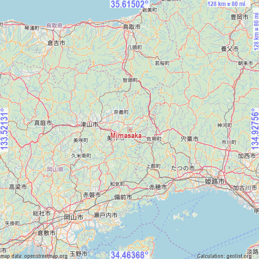
Mimasaka GPS coordinates[2]
35° 2' 28.968" North, 134° 13' 27.948" East
| Map corner | latitude | longitude |
|---|---|---|
| Upper-left | 35.61502°, | 133.52131° |
| Center: | 35.04138°, | 134.22443° |
| Lower-right: | 34.46368°, | 134.92756° |
| Map W x H: | 128×128 km | = 79.5×79.5mi |
| max Lat: | 45.40944° ⇑57.2% North |
| Mimasaka: | 35.04138° |
| min Lat: | ⇓42.8% South 24.34478° |
| min Long | Mimasaka | max Long |
| 123° | 134.22443° | 145.575° |
| W 25.9%⇐ | ⇒74.1% E |
Elevation
Elevation of Mimasaka is 196 m = 643 ft, and this is 111.4 m = 365 ft above average elevation for this country.
| Max E: |
1086 m = 3563 ft | 12.2% |
| Mimasaka | 196 m 643 ft | |
| Avg. | 84.6 m = 278 ft | |
Min E: |
-2 m = -7 ft | 87.8% |
See also: Japan elevation on elevation.city.
Geographical zone
Mimasaka is located in North temperate zone (between Tropic of Cancer and the Arctic Circle). Distance of this Northern Tropic circle is 1290.3 km =801.8 mi to South.| Distance of | km | miles | from Mimasaka |
|---|---|---|---|
| North Pole | 6110.8 | 3797.1 | to North |
| Arctic Circle | 3504.9 | 2177.8 | to North |
| Tropic Cancer | 1290.3 | 801.8 | to South |
| Equator | 3896.2 | 2421 | to South |


Nearby cities:
15 places around Mimasaka: (largest is in red/bold)
• Aioi
34.5 km =21.4 mi,  139°
139°
• Akaiwa
31.7 km =19.7 mi,  215°
215°
• Ako
34 km =21.1 mi,  156°
156°
• Bizen
28.3 km =17.6 mi,  177°
177°
• Himeji
50 km =31.1 mi,  119°
119°
• Kariya
35.5 km =22.1 mi, 155°
• Maniwa
46.5 km =28.9 mi,  278°
278°
• Okayama
51 km =31.7 mi,  211°
211°
• Setouchi
43.2 km =26.8 mi,  189°
189°
• Shisō
31.6 km =19.6 mi,  102°
102°
• Tatsuno
37.3 km =23.2 mi,  128°
128°
• Tatsunochō-tominaga
35.8 km =22.2 mi, 123°
• Tottori
51 km =31.7 mi,  0°
0°
• Tsuyama
20.6 km =12.8 mi,  273°
273°
• Yamazakichō-nakabirose
30 km =18.6 mi, 98°
Sources, notices
• [Note1] Compared only with cities in Japan existing in our database
• [Src1] Map data: © OpenStreetMap contributors (CC-BY-SA)
• [Src2] Other city data from geonames.org with taken over terms of usage.
• [Src3] Geographical zone / Annual Mean Temperature by Robert A. Rohde @ Wikipedia
