Shisō geodata
Shisō (Hyōgo) is a seat of a second-order administrative division; located in Japan in Asia/Tokyo (GMT+9) time zone. In our database, there are 767 cities with bigger population. Compared to other cities in Japan, 59.5% of cities are located further ↑North; 72.8% of cities are located further →East and 89.5% of cities have lower elevation than Shisō. Note1


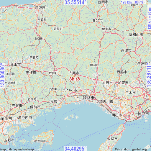
Shisō GPS coordinates[2]
34° 58' 51.852" North, 134° 33' 50.328" East
| Map corner | latitude | longitude |
|---|---|---|
| Upper-left | 35.55514°, | 133.86086° |
| Center: | 34.98107°, | 134.56398° |
| Lower-right: | 34.40295°, | 135.26711° |
| Map W x H: | 128.1×128.1 km | = 79.6×79.6mi |
| max Lat: | 45.40944° ⇑59.5% North |
| Shisō: | 34.98107° |
| min Lat: | ⇓40.5% South 24.34478° |
| min Long | Shisō | max Long |
| 123° | 134.56398° | 145.575° |
| W 27.2%⇐ | ⇒72.8% E |
Elevation
Elevation of Shisō is 215 m = 705 ft, and this is 130.4 m = 428 ft above average elevation for this country.
| Max E: |
1086 m = 3563 ft | 10.5% |
| Shisō | 215 m 705 ft | |
| Avg. | 84.6 m = 278 ft | |
Min E: |
-2 m = -7 ft | 89.5% |
See also: Japan elevation on elevation.city.
Geographical zone
Shisō is located in North temperate zone (between Tropic of Cancer and the Arctic Circle). Distance of this Northern Tropic circle is 1283.6 km =797.6 mi to South.| Distance of | km | miles | from Shisō |
|---|---|---|---|
| North Pole | 6117.5 | 3801.2 | to North |
| Arctic Circle | 3511.6 | 2182 | to North |
| Tropic Cancer | 1283.6 | 797.6 | to South |
| Equator | 3889.5 | 2416.8 | to South |


Nearby cities:
15 places around Shisō: (largest is in red/bold)
• Aioi
21.6 km =13.4 mi,  203°
203°
• Ako
30.3 km =18.8 mi,  215°
215°
• Bizen
36.9 km =22.9 mi,  234°
234°
• Himeji
22.1 km =13.7 mi,  145°
145°
• Kakogawachō-honmachi
33.7 km =20.9 mi,  134°
134°
• Kariya
30.2 km =18.8 mi,  212°
212°
• Kasai
26.4 km =16.4 mi,  103°
103°
• Mimasaka
31.6 km =19.6 mi,  282°
282°
• Ono
36.7 km =22.8 mi,  113°
113°
• Shirahamachō-usazakiminami
26 km =16.2 mi, 147°
• Takasago
32 km =19.9 mi,  139°
139°
• Tatsuno
16.7 km =10.4 mi,  186°
186°
• Tatsunochō-tominaga
13 km =8.1 mi,  184°
184°
• Yamazakichō-nakabirose
2.5 km =1.6 mi,  328°
328°
• Yonedacho Sendo
33 km =20.5 mi, 133°
Sources, notices
• [Note1] Compared only with cities in Japan existing in our database
• [Src1] Map data: © OpenStreetMap contributors (CC-BY-SA)
• [Src2] Other city data from geonames.org with taken over terms of usage.
• [Src3] Geographical zone / Annual Mean Temperature by Robert A. Rohde @ Wikipedia
