Asago geodata
Asago (Hyōgo) is a seat of a second-order administrative division; located in Japan in Asia/Tokyo (GMT+9) time zone. In our database, there are 767 cities with bigger population. Compared to other cities in Japan, 52.8% of cities are located further ↑North; 71.7% of cities are located further →East and 80.4% of cities have lower elevation than Asago. Note1


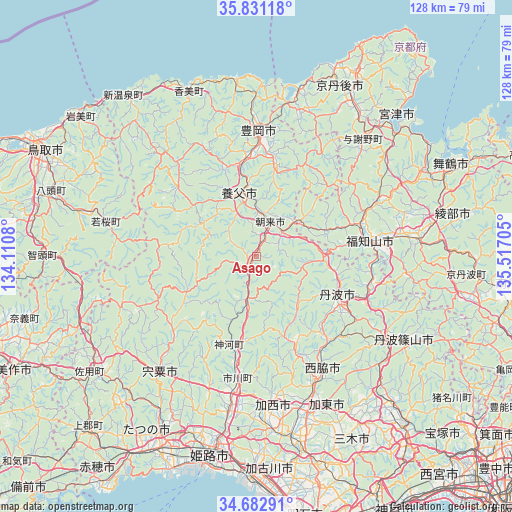
Asago GPS coordinates[2]
35° 15' 32.688" North, 134° 48' 50.112" East
| Map corner | latitude | longitude |
|---|---|---|
| Upper-left | 35.83118°, | 134.1108° |
| Center: | 35.25908°, | 134.81392° |
| Lower-right: | 34.68291°, | 135.51705° |
| Map W x H: | 127.7×127.7 km | = 79.3×79.3mi |
| max Lat: | 45.40944° ⇑52.8% North |
| Asago: | 35.25908° |
| min Lat: | ⇓47.2% South 24.34478° |
| min Long | Asago | max Long |
| 123° | 134.81392° | 145.575° |
| W 28.3%⇐ | ⇒71.7% E |
Elevation
Elevation of Asago is 125 m = 410 ft, and this is 40.4 m = 133 ft above average elevation for this country.
| Max E: |
1086 m = 3563 ft | 19.6% |
| Asago | 125 m 410 ft | |
| Avg. | 84.6 m = 278 ft | |
Min E: |
-2 m = -7 ft | 80.4% |
See also: Japan elevation on elevation.city.
Geographical zone
Asago is located in North temperate zone (between Tropic of Cancer and the Arctic Circle). Distance of this Northern Tropic circle is 1314.5 km =816.8 mi to South.| Distance of | km | miles | from Asago |
|---|---|---|---|
| North Pole | 6086.6 | 3782 | to North |
| Arctic Circle | 3480.7 | 2162.8 | to North |
| Tropic Cancer | 1314.5 | 816.8 | to South |
| Equator | 3920.4 | 2436 | to South |


Nearby cities:
15 places around Asago: (largest is in red/bold)
• Ayabe
39.8 km =24.7 mi,  83°
83°
• Fukuchiyama
27.9 km =17.3 mi, 80°
• Kasai
37.1 km =23.1 mi,  175°
175°
• Katō
41.9 km =26 mi,  152°
152°
• Kyōtango
43.9 km =27.3 mi,  28°
28°
• Miyazu
45.3 km =28.1 mi,  47°
47°
• Nishiwaki
33.9 km =21.1 mi, 154°
• Ono
46.8 km =29.1 mi,  166°
166°
• Sasayama
42.4 km =26.3 mi,  120°
120°
• Shisō
38.4 km =23.9 mi,  216°
216°
• Tanba
23.2 km =14.4 mi, 118°
• Toyooka
31.2 km =19.4 mi,  1°
1°
• Yabu
16.5 km =10.3 mi,  346°
346°
• Yamazakichō-nakabirose
37.5 km =23.3 mi, 219°
• Yashiro
40.5 km =25.2 mi,  159°
159°
Sources, notices
• [Note1] Compared only with cities in Japan existing in our database
• [Src1] Map data: © OpenStreetMap contributors (CC-BY-SA)
• [Src2] Other city data from geonames.org with taken over terms of usage.
• [Src3] Geographical zone / Annual Mean Temperature by Robert A. Rohde @ Wikipedia
