Tatebayashi geodata
Tatebayashi (Gunma) is a seat of a second-order administrative division; located in Japan in Asia/Tokyo (GMT+9) time zone. With population of 81,274 people, there are 248 cities with bigger population in this country. Compared to other cities in Japan, 72.4% of cities are located further ↓South; 69.5% of cities are located further ←West and 50.1% of cities have higher elevation than Tatebayashi. Note1


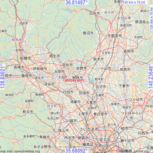
Tatebayashi GPS coordinates[2]
36° 15' 0" North, 139° 31' 59.988" East
| Map corner | latitude | longitude |
|---|---|---|
| Upper-left | 36.81497°, | 138.83021° |
| Center: | 36.25°, | 139.53333° |
| Lower-right: | 35.68092°, | 140.23646° |
| Map W x H: | 126.1×126.1 km | = 78.4×78.4mi |
| max Lat: | 45.40944° ⇑27.6% North |
| Tatebayashi: | 36.25° |
| min Lat: | ⇓72.4% South 24.34478° |
| min Long | Tatebayashi | max Long |
| 123° | 139.53333° | 145.575° |
| W 69.5%⇐ | ⇒30.5% E |
Elevation
Elevation of Tatebayashi is 28 m = 92 ft, and this is 56.6 m = 186 ft below average elevation for this country.
| Max E: |
1086 m = 3563 ft | 50.1% |
| Avg. | 84.6 m = 278 ft | |
| Tatebayashi | 28 m = 92 ft | |
Min E: |
-2 m = -7 ft | 49.9% |
See also: Tatebayashi elevation on elevation.city.
Geographical zone
Tatebayashi is located in North temperate zone (between Tropic of Cancer and the Arctic Circle). Distance of this Northern Tropic circle is 1424.7 km =885.3 mi to South.| Distance of | km | miles | from Tatebayashi |
|---|---|---|---|
| North Pole | 5976.4 | 3713.6 | to North |
| Arctic Circle | 3370.6 | 2094.4 | to North |
| Tropic Cancer | 1424.7 | 885.3 | to South |
| Equator | 4030.6 | 2504.5 | to South |


Nearby cities:
15 places around Tatebayashi: (largest is in red/bold)
• Ashikaga
11.9 km =7.4 mi,  321°
321°
• Fujioka
10.5 km =6.5 mi,  90°
90°
• Fukiage-fujimi
18.3 km =11.4 mi,  204°
204°
• Gyōda
13.8 km =8.6 mi,  208°
208°
• Hanyū
9.3 km =5.8 mi,  180°
180°
• Kazo
16 km =9.9 mi,  158°
158°
• Kisai
17.3 km =10.7 mi, 164°
• Koga
18 km =11.2 mi,  114°
114°
• Kumagaya
18.1 km =11.2 mi,  225°
225°
• Kurihashi
19.8 km =12.3 mi,  130°
130°
• Kōnosu
20.2 km =12.6 mi, 184°
• Menuma
13.9 km =8.6 mi,  257°
257°
• Sano
8.7 km =5.4 mi,  31°
31°
• Tanuma
13.7 km =8.5 mi,  19°
19°
• Ōta
15.9 km =9.9 mi,  290°
290°
Sources, notices
• [Note1] Compared only with cities in Japan existing in our database
• [Src1] Map data: © OpenStreetMap contributors (CC-BY-SA)
• [Src2] Other city data from geonames.org with taken over terms of usage.
• [Src3] Geographical zone / Annual Mean Temperature by Robert A. Rohde @ Wikipedia
