Koga geodata
Koga (Ibaraki) is a seat of a second-order administrative division; located in Japan in Asia/Tokyo (GMT+9) time zone. With population of 58,004 people, there are 334 cities with bigger population in this country. Compared to other cities in Japan, 71.1% of cities are located further ↓South; 73.6% of cities are located further ←West and 62.8% of cities have higher elevation than Koga. Note1


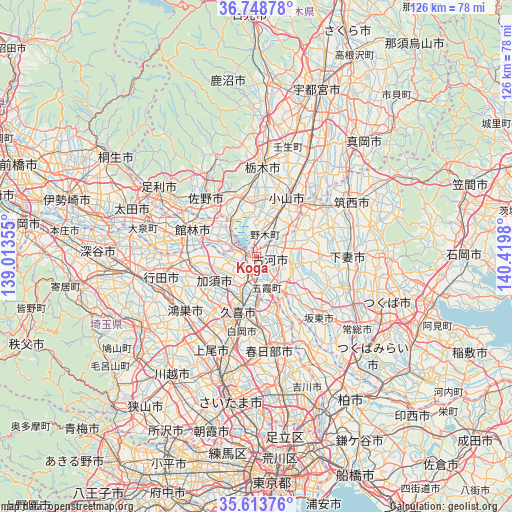
Koga GPS coordinates[2]
36° 10' 59.988" North, 139° 43' 0.012" East
| Map corner | latitude | longitude |
|---|---|---|
| Upper-left | 36.74878°, | 139.01355° |
| Center: | 36.18333°, | 139.71667° |
| Lower-right: | 35.61376°, | 140.4198° |
| Map W x H: | 126.2×126.2 km | = 78.4×78.4mi |
| max Lat: | 45.40944° ⇑28.9% North |
| Koga: | 36.18333° |
| min Lat: | ⇓71.1% South 24.34478° |
| min Long | Koga | max Long |
| 123° | 139.71667° | 145.575° |
| W 73.6%⇐ | ⇒26.4% E |
Elevation
Elevation of Koga is 17 m = 56 ft, and this is 67.6 m = 222 ft below average elevation for this country.
| Max E: |
1086 m = 3563 ft | 62.8% |
| Avg. | 84.6 m = 278 ft | |
| Koga | 17 m = 56 ft | |
Min E: |
-2 m = -7 ft | 37.2% |
See also: Koga elevation on elevation.city.
Geographical zone
Koga is located in North temperate zone (between Tropic of Cancer and the Arctic Circle). Distance of this Northern Tropic circle is 1417.3 km =880.7 mi to South.| Distance of | km | miles | from Koga |
|---|---|---|---|
| North Pole | 5983.9 | 3718.2 | to North |
| Arctic Circle | 3378 | 2099 | to North |
| Tropic Cancer | 1417.3 | 880.7 | to South |
| Equator | 4023.2 | 2499.9 | to South |


Nearby cities:
15 places around Koga: (largest is in red/bold)
• Bandō
18.5 km =11.5 mi,  133°
133°
• Fujioka
9.5 km =5.9 mi,  321°
321°
• Hanyū
16.6 km =10.3 mi,  263°
263°
• Kazo
12.8 km =8 mi,  234°
234°
• Kisai
15.1 km =9.4 mi, 232°
• Kukichūō
13.4 km =8.3 mi,  196°
196°
• Kurihashi
5.8 km =3.6 mi, 195°
• Oyama
15 km =9.3 mi,  29°
29°
• Sakai
11.9 km =7.4 mi,  141°
141°
• Sano
19 km =11.8 mi, 321°
• Satte
12.3 km =7.6 mi,  176°
176°
• Shiraoka
19 km =11.8 mi, 195°
• Shōbu
16.7 km =10.4 mi,  218°
218°
• Sugito
17 km =10.6 mi, 177°
• Tatebayashi
18 km =11.2 mi,  294°
294°
Sources, notices
• [Note1] Compared only with cities in Japan existing in our database
• [Src1] Map data: © OpenStreetMap contributors (CC-BY-SA)
• [Src2] Other city data from geonames.org with taken over terms of usage.
• [Src3] Geographical zone / Annual Mean Temperature by Robert A. Rohde @ Wikipedia
