Sakaidechō geodata
Sakaidechō (Kagawa) is a seat of a second-order administrative division; located in Japan in Asia/Tokyo (GMT+9) time zone. With population of 57,090 people, there are 341 cities with bigger population in this country. Compared to other cities in Japan, 75.7% of cities are located further ↑North; 75.6% of cities are located further →East and 71.1% of cities have higher elevation than Sakaidechō. Note1


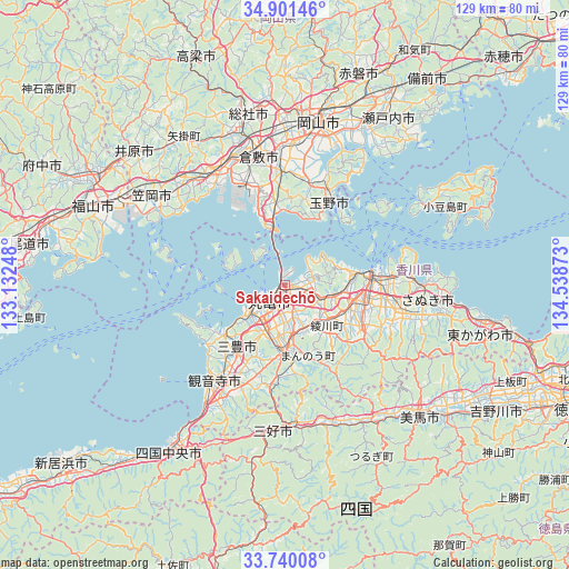
Sakaidechō GPS coordinates[2]
34° 19' 22.008" North, 133° 50' 8.16" East
| Map corner | latitude | longitude |
|---|---|---|
| Upper-left | 34.90146°, | 133.13248° |
| Center: | 34.32278°, | 133.8356° |
| Lower-right: | 33.74008°, | 134.53873° |
| Map W x H: | 129.1×129.1 km | = 80.2×80.2mi |
| max Lat: | 45.40944° ⇑75.7% North |
| Sakaidechō: | 34.32278° |
| min Lat: | ⇓24.3% South 24.34478° |
| min Long | Sakaidechō | max Long |
| 123° | 133.8356° | 145.575° |
| W 24.4%⇐ | ⇒75.6% E |
Elevation
Elevation of Sakaidechō is 11 m = 36 ft, and this is 73.6 m = 241 ft below average elevation for this country.
| Max E: |
1086 m = 3563 ft | 71.1% |
| Avg. | 84.6 m = 278 ft | |
| Sakaidechō | 11 m = 36 ft | |
Min E: |
-2 m = -7 ft | 28.9% |
See also: Sakaidechō elevation on elevation.city.
Geographical zone
Sakaidechō is located in North temperate zone (between Tropic of Cancer and the Arctic Circle). Distance of this Northern Tropic circle is 1210.4 km =752.1 mi to South.| Distance of | km | miles | from Sakaidechō |
|---|---|---|---|
| North Pole | 6190.7 | 3846.7 | to North |
| Arctic Circle | 3584.8 | 2227.5 | to North |
| Tropic Cancer | 1210.4 | 752.1 | to South |
| Equator | 3816.3 | 2371.3 | to South |


Nearby cities:
15 places around Sakaidechō: (largest is in red/bold)
• Asakuchi
31.8 km =19.8 mi,  317°
317°
• Ikedachō
32.8 km =20.4 mi,  184°
184°
• Kamogatachō-kamogata
32.8 km =20.4 mi, 316°
• Kan’onji
33 km =20.5 mi,  211°
211°
• Kan’onjichō
27.8 km =17.3 mi,  218°
218°
• Kasaoka
36.6 km =22.7 mi,  303°
303°
• Kurashiki
29.7 km =18.5 mi,  347°
347°
• Marugame
6.5 km =4 mi,  227°
227°
• Mitoyo
19.4 km =12.1 mi, 229°
• Shido
31 km =19.3 mi,  89°
89°
• Tadotsu
9.5 km =5.9 mi,  235°
235°
• Takamatsu
19.7 km =12.2 mi, 86°
• Tamano
23.9 km =14.9 mi,  25°
25°
• Tonoshō
35.3 km =21.9 mi,  60°
60°
• Zentsujichó
11.9 km =7.4 mi, 206°
Sources, notices
• [Note1] Compared only with cities in Japan existing in our database
• [Src1] Map data: © OpenStreetMap contributors (CC-BY-SA)
• [Src2] Other city data from geonames.org with taken over terms of usage.
• [Src3] Geographical zone / Annual Mean Temperature by Robert A. Rohde @ Wikipedia
