Odawara geodata
Odawara (Kanagawa) is a seat of a second-order administrative division; located in Japan in Asia/Tokyo (GMT+9) time zone. With population of 203,035 people, there are 102 cities with bigger population in this country. Compared to other cities in Japan, 52.8% of cities are located further ↑North; 62.5% of cities are located further ←West and 65.3% of cities have higher elevation than Odawara. Note1


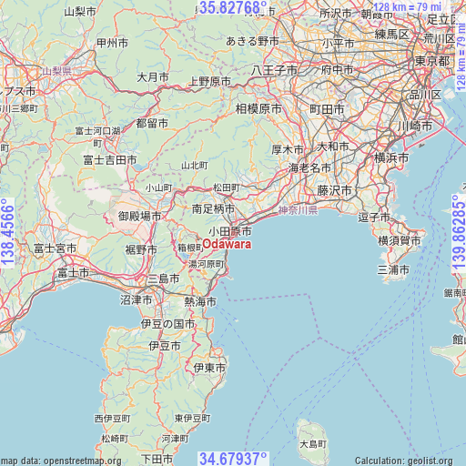
Odawara GPS coordinates[2]
35° 15' 20.016" North, 139° 9' 34.992" East
| Map corner | latitude | longitude |
|---|---|---|
| Upper-left | 35.82768°, | 138.4566° |
| Center: | 35.25556°, | 139.15972° |
| Lower-right: | 34.67937°, | 139.86285° |
| Map W x H: | 127.7×127.7 km | = 79.3×79.3mi |
| max Lat: | 45.40944° ⇑52.8% North |
| Odawara: | 35.25556° |
| min Lat: | ⇓47.2% South 24.34478° |
| min Long | Odawara | max Long |
| 123° | 139.15972° | 145.575° |
| W 62.5%⇐ | ⇒37.5% E |
Elevation
Elevation of Odawara is 15 m = 49 ft, and this is 69.6 m = 228 ft below average elevation for this country.
| Max E: |
1086 m = 3563 ft | 65.3% |
| Avg. | 84.6 m = 278 ft | |
| Odawara | 15 m = 49 ft | |
Min E: |
-2 m = -7 ft | 34.7% |
See also: Odawara elevation on elevation.city.
Geographical zone
Odawara is located in North temperate zone (between Tropic of Cancer and the Arctic Circle). Distance of this Northern Tropic circle is 1314.1 km =816.5 mi to South.| Distance of | km | miles | from Odawara |
|---|---|---|---|
| North Pole | 6087 | 3782.3 | to North |
| Arctic Circle | 3481.1 | 2163.1 | to North |
| Tropic Cancer | 1314.1 | 816.5 | to South |
| Equator | 3920.1 | 2435.8 | to South |


Nearby cities:
15 places around Odawara: (largest is in red/bold)
• Atami
21 km =13 mi,  207°
207°
• Atsugi
28.2 km =17.5 mi,  42°
42°
• Chigasaki
23.9 km =14.9 mi,  67°
67°
• Gotenba
20.8 km =12.9 mi,  289°
289°
• Hadano
14.1 km =8.8 mi,  24°
24°
• Hakone
14.2 km =8.8 mi,  238°
238°
• Hiratsuka
18 km =11.2 mi,  63°
63°
• Isehara
21 km =13 mi, 40°
• Minamiashigara
8.4 km =5.2 mi,  327°
327°
• Mishima
27 km =16.8 mi, 235°
• Ninomiya
10.1 km =6.3 mi, 59°
• Susono
24.7 km =15.3 mi,  248°
248°
• Yamakita
14 km =8.7 mi, 328°
• Yugawara
14.5 km =9 mi,  215°
215°
• Ōiso
15.7 km =9.8 mi, 64°
Sources, notices
• [Note1] Compared only with cities in Japan existing in our database
• [Src1] Map data: © OpenStreetMap contributors (CC-BY-SA)
• [Src2] Other city data from geonames.org with taken over terms of usage.
• [Src3] Geographical zone / Annual Mean Temperature by Robert A. Rohde @ Wikipedia
