Niihama geodata
Niihama (Ehime) is a seat of a second-order administrative division; located in Japan in Asia/Tokyo (GMT+9) time zone. With population of 123,059 people, there are 171 cities with bigger population in this country. Compared to other cities in Japan, 80.7% of cities are located further ↑North; 78.2% of cities are located further →East and 68.3% of cities have higher elevation than Niihama. Note1


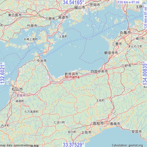
Niihama GPS coordinates[2]
33° 57' 37.692" North, 133° 18' 18.792" East
| Map corner | latitude | longitude |
|---|---|---|
| Upper-left | 34.54165°, | 132.6021° |
| Center: | 33.96047°, | 133.30522° |
| Lower-right: | 33.37529°, | 134.00835° |
| Map W x H: | 129.7×129.7 km | = 80.6×80.6mi |
| max Lat: | 45.40944° ⇑80.7% North |
| Niihama: | 33.96047° |
| min Lat: | ⇓19.3% South 24.34478° |
| min Long | Niihama | max Long |
| 123° | 133.30522° | 145.575° |
| W 21.8%⇐ | ⇒78.2% E |
Elevation
Elevation of Niihama is 13 m = 43 ft, and this is 71.6 m = 235 ft below average elevation for this country.
| Max E: |
1086 m = 3563 ft | 68.3% |
| Avg. | 84.6 m = 278 ft | |
| Niihama | 13 m = 43 ft | |
Min E: |
-2 m = -7 ft | 31.7% |
See also: Niihama elevation on elevation.city.
Geographical zone
Niihama is located in North temperate zone (between Tropic of Cancer and the Arctic Circle). Distance of this Northern Tropic circle is 1170.1 km =727.1 mi to South.| Distance of | km | miles | from Niihama |
|---|---|---|---|
| North Pole | 6231 | 3871.8 | to North |
| Arctic Circle | 3625.1 | 2252.5 | to North |
| Tropic Cancer | 1170.1 | 727.1 | to South |
| Equator | 3776.1 | 2346.4 | to South |


Nearby cities:
15 places around Niihama: (largest is in red/bold)
• Hōjō
48.7 km =30.3 mi,  272°
272°
• Ikedachō
46.8 km =29.1 mi,  80°
80°
• Imabari-shi
30.6 km =19 mi,  293°
293°
• Innoshima
37.6 km =23.4 mi,  342°
342°
• Ino
47.2 km =29.3 mi,  165°
165°
• Kan’onji
33.9 km =21.1 mi,  69°
69°
• Kan’onjichō
36.5 km =22.7 mi,  59°
59°
• Kawanoechō
25.9 km =16.1 mi, 76°
• Kochi
50.3 km =31.3 mi,  155°
155°
• Matsuyama
51.6 km =32.1 mi,  254°
254°
• Mitoyo
43.9 km =27.3 mi,  50°
50°
• Miyoshi
51 km =31.7 mi,  94°
94°
• Saijō
12.3 km =7.6 mi, 246°
• Shikokuchūō
22.5 km =14 mi, 85°
• Tōon
42.5 km =26.4 mi,  244°
244°
Sources, notices
• [Note1] Compared only with cities in Japan existing in our database
• [Src1] Map data: © OpenStreetMap contributors (CC-BY-SA)
• [Src2] Other city data from geonames.org with taken over terms of usage.
• [Src3] Geographical zone / Annual Mean Temperature by Robert A. Rohde @ Wikipedia
